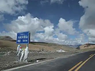
Mayum La
| Mayum La | |
|---|---|
 G219 at Mayum La | |
| Elevation | 5,211 m (17,096 ft) |
| Traversed by | |
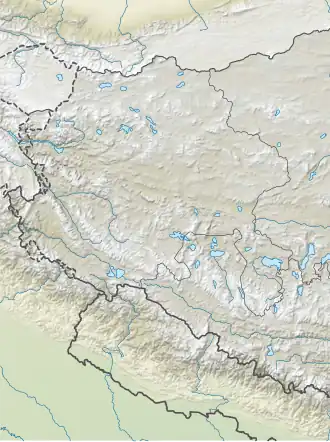
| Location | Burang, Ngari, Tibet, China |
| Range | Gangdise Shan, Transhimalaya, Tibetan Plateau |
| Coordinates | 30°36′53″N 82°25′38″E / 30.6147°N 82.4271°E |
 Mayum La | |
| Tibetan name | |||||||
|---|---|---|---|---|---|---|---|
| Tibetan | མ་ཡུམ་ལ | ||||||
| |||||||
| Chinese name | |||||||
| Simplified Chinese | 马攸木拉 | ||||||
| |||||||
Mayum La (Chinese: 马攸木拉达坂), also known as Mariám La,[1] is a mountain pass to the east of Lake Manasarovar. It separates the drainage divide of the Dangque Zangbo, which is a headwater of Yarlung Tsangpo (Brahmaputra), and Langqen Zangbo (Sutlej River) in Tibet.
References
- ^ Thomas Hungerford Holdich, Tibet, the Mysterious, Asian Educational Services, 1996 - Tibet Autonomous Region (China), p.233, accessed at Google Books 2014-09-21
Mountain passes of China | |||||||||||||||||||
|---|---|---|---|---|---|---|---|---|---|---|---|---|---|---|---|---|---|---|---|
| On the border | |||||||||||||||||||
| In the interior |
| ||||||||||||||||||
| |||||||||||||||||||