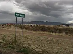
McNeal, Arizona
McNeal, Arizona | |
|---|---|
 | |
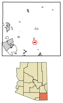 Location of McNeal in Cochise County, Arizona. | |
 McNeal  McNeal | |
| Coordinates: 31°36′28″N 109°40′12″W / 31.60778°N 109.67000°W | |
| Country | United States |
| State | Arizona |
| County | Cochise |
| Area | |
• Total | 3.75 sq mi (9.71 km2) |
| • Land | 3.75 sq mi (9.71 km2) |
| • Water | 0.00 sq mi (0.00 km2) |
| Elevation | 4,164 ft (1,269 m) |
| Population (2020) | |
• Total | 182 |
| • Density | 48.57/sq mi (18.75/km2) |
| Time zone | UTC-7 (Mountain (MST)) |
| ZIP code | 85617 |
| Area code | 520 |
| GNIS feature ID | 2582820[2] |
McNeal is an unincorporated community and census-designated place in Cochise County, Arizona, United States. As of the 2010 United States Census it had a population of 238.[3] McNeal is located on U.S. Route 191, 21 miles (34 km) northwest of Douglas. McNeal has the United States Postal Service zip code of 85617.
Demographics
| Census | Pop. | Note | %± |
|---|---|---|---|
| 2020 | 182 | — | |
| U.S. Decennial Census[4] | |||
Climate
According to the Köppen Climate Classification system, McNeal has a semi-arid climate, abbreviated "BSk" on climate maps.[5]
References
- ^ "2020 U.S. Gazetteer Files". United States Census Bureau. Retrieved October 29, 2021.
- ^ a b U.S. Geological Survey Geographic Names Information System: McNeal, Arizona
- ^ "Geographic Identifiers: 2010 Demographic Profile Data (G001): McNeal CDP, Arizona". U.S. Census Bureau, American Factfinder. Archived from the original on February 12, 2020. Retrieved June 12, 2014.
- ^ "Census of Population and Housing". Census.gov. Retrieved June 4, 2016.
- ^ Climate Summary for McNeal, Arizona
Municipalities and communities of Cochise County, Arizona, United States | ||
|---|---|---|
| Cities |  | |
| Towns | ||
| CDPs | ||
| Other populated places | ||
| Ghost towns | ||