Meljak
Meljak
Мељак | |
|---|---|
 Entrance sign to Meljak | |
 Meljak | |
| Coordinates: 44°37′05″N 20°21′47″E / 44.61806°N 20.36306°E | |
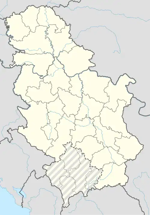
| Country | |
| Region | Belgrade |
| Municipality | Barajevo |
| Area | |
• Total | 6.61 km2 (2.55 sq mi) |
| Population (2011) | |
• Total | 2.208 |
| • Density | 0.33/km2 (0.87/sq mi) |
| Time zone | UTC+1 (CET) |
| • Summer (DST) | UTC+2 (CEST) |
Meljak (Serbian Cyrillic: Мељак) is a suburban settlement of Belgrade, Serbia. It is located in the municipality of Barajevo.
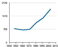
It is located northeast of the municipal seat of Barajevo. It is a rural settlement and thanks to its location on the Ibarska magistrala (Highway of Ibar), one of the fastest growing in the municipality. It grew from a population of 1,307 (Census 1991) to 1,772 (Census 2002), with an average annual growth of 2.8%.
Meljak was part of the municipality of Umka which was abolished in 1960 and divided between the municipalities of Čukarica and Barajevo (Meljak and Vranić).
Demographics
| year | population |
|---|---|
| 1981 | 1065 |
| 1991 | 1307 |
| 2002 | 1772 |
| 2011 | 2208 |
References
- ^ "Насеља општине Барајево" (PDF). stat.gov.rs (in Serbian). Statistical Office of Serbia. Retrieved 22 October 2019.
- ^ "Мељак (Барајево)". Vikipedija, Slobodna Enciklopedija (in Serbian (Latin script)). 2017-10-15.