Mellenville, New York
Mellenville, New York | |
|---|---|
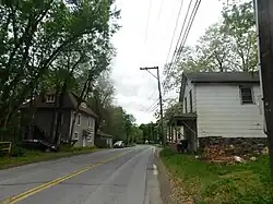 NY 217 westbound through Mellenville | |
 Mellenville  Mellenville | |
| Coordinates: 42°15′11″N 73°40′03″W / 42.25306°N 73.66750°W | |
| Country | United States |
| State | New York |
| County | Columbia |
| Elevation | 269 ft (82 m) |
| Time zone | UTC-5 (Eastern (EST)) |
| • Summer (DST) | UTC-4 (EDT) |
| ZIP code | 12544 |
| Area codes | 518 & 838 |
| GNIS feature ID | 956923[1] |
Mellenville is a hamlet in Columbia County, New York, United States. The community is located along New York State Route 217 0.8 miles (1.3 km) west of Philmont. Mellenville has a post office with ZIP code 12544.[2][3]
References
- ^ "Mellenville". Geographic Names Information System. United States Geological Survey, United States Department of the Interior.
- ^ United States Postal Service. "USPS - Look Up a ZIP Code". Retrieved September 10, 2017.
- ^ "Postmaster Finder - Post Offices by ZIP Code". United States Postal Service. Retrieved September 10, 2017.
Municipalities and communities of Columbia County, New York, United States | ||
|---|---|---|
| City |  | |
| Towns | ||
| Villages | ||
| CDPs | ||
| Other hamlets | ||
| Footnotes | ‡This populated place also has portions in an adjacent county or counties | |