Menameradiel
Menameradiel
Menaldumadeel | |
|---|---|
Former municipality | |
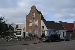 Town square in Berlikum | |
 Flag  Coat of arms | |
.svg.png) Location in Friesland | |
| Coordinates: 53°13′N 5°40′E / 53.217°N 5.667°E | |
| Country | Netherlands |
| Province | Friesland |
| Municipality | Waadhoeke |
| Area | |
• Total | 70.03 km2 (27.04 sq mi) |
| • Land | 68.87 km2 (26.59 sq mi) |
| • Water | 1.16 km2 (0.45 sq mi) |
| Elevation | 1 m (3 ft) |
| Population (January 2021)[3] | |
• Total | data missing |
| Time zone | UTC+1 (CET) |
| • Summer (DST) | UTC+2 (CEST) |
| Postcode | 8816, 9030–9045 |
| Area code | 0517, 0518, 058 |
| Website | www |
Menameradiel (West Frisian: [məˈnaːməraˌdiəl] ⓘ; Dutch: Menaldumadeel [meːˈnɑldʏmaːˌdeːl] ⓘ) is a former municipality in Friesland, Netherlands. On 1 January 2018 it merged with the municipalities of Franekeradeel, het Bildt and parts of Littenseradiel to form the new municipality Waadhoeke.
Population centres
Population centres as of 1 January 2007:
- Beetgum (754)
- Beetgumermolen (944)
- Berlikum (2,492)
- Blessum (92)
- Boksum (449)
- Deinum (1,071)
- Dronryp (3,427)
- Engelum (415)
- Kleaster-Anjum (50)
- Marssum (1,156)
- Menaam (2,612)
- Schingen (108)
- Slappeterp (80)
- Wier (207).
Topography
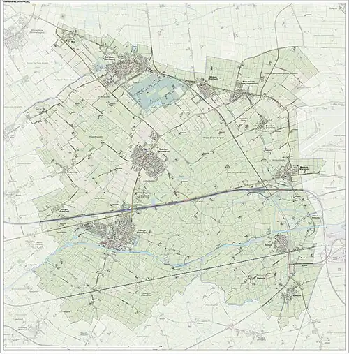
Dutch Topographic map of the former municipality of Menaldumadeel, June 2015
References
- ^ "Kerncijfers wijken en buurten 2020" [Key figures for neighbourhoods 2020]. StatLine (in Dutch). CBS. 24 July 2020. Retrieved 19 September 2020.
- ^ "Postcodetool for 9036MS". Actueel Hoogtebestand Nederland (in Dutch). Het Waterschapshuis. Archived from the original on 21 September 2013. Retrieved 22 September 2013.
- ^ "Bevolkingsontwikkeling; regio per maand" [Population growth; regions per month]. CBS Statline (in Dutch). CBS. 1 January 2021. Retrieved 2 January 2022.
External links
![]() Media related to Menameradiel at Wikimedia Commons
Media related to Menameradiel at Wikimedia Commons
Neighbouring municipalities at time of dissolution | ||||||||||||||||
|---|---|---|---|---|---|---|---|---|---|---|---|---|---|---|---|---|
| ||||||||||||||||