Meniida
Meniida
Μενηίδα | |
|---|---|
 Meniida Location within the regional unit 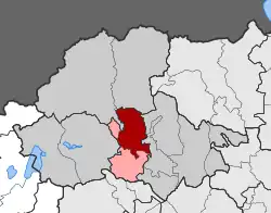 | |
| Coordinates: 40°51′N 22°11′E / 40.850°N 22.183°E | |
| Country | Greece |
| Administrative region | Central Macedonia |
| Regional unit | Pella |
| Municipality | Skydra |
| Area | |
| • Municipal unit | 118.6 km2 (45.8 sq mi) |
| Population (2021)[1] | |
| • Municipal unit | 3,972 |
| • Municipal unit density | 33/km2 (87/sq mi) |
| Time zone | UTC+2 (EET) |
| • Summer (DST) | UTC+3 (EEST) |
| Vehicle registration | ΕΕ |
Meniida (Greek: Μενηίδα) is a former municipality in the Pella regional unit, Greece. Since the 2011 local government reform, it is part of the municipality Skydra, of which it is a municipal unit.[2] The municipal unit has an area of 118.562 km2.[3] Population 3,972 (2021).[1] The seat of the municipality was in Kali.
Subdivisions
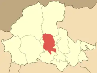
The 6 communities of Meniida are:
| Map | Community | Population (2021)[1] |
|---|---|---|
 | ||
| Anydro | 338 | |
| Kali | 1,222 | |
| Kallipoli (incl. Sandali) | 516 | |
| Kranea (incl. Litharia) | 64 | |
| Mandalo | 941 | |
| Profitis Ilias | 890 | |
| Municipal unit of Meniida | 3,972 |
Historical Population
| Year | Population |
|---|---|
| 2001[4] | 5,493 |
| 2011[5] | 4,575 |
| 2021[1] | 3,792 |
References
- ^ a b c d "Αποτελέσματα Απογραφής Πληθυσμού - Κατοικιών 2021, Μόνιμος Πληθυσμός κατά οικισμό" [Results of the 2021 Population - Housing Census, Permanent population by settlement] (in Greek). Hellenic Statistical Authority. 29 March 2024.
- ^ "ΦΕΚ B 1292/2010, Kallikratis reform municipalities" (in Greek). Government Gazette.
- ^ "Population & housing census 2001 (incl. area and average elevation)" (PDF) (in Greek). National Statistical Service of Greece. Archived from the original (PDF) on 2015-09-21.
- ^ "Detailed census results 2001" (PDF). Archived from the original (PDF) on 2013-01-31. (39 MB) (in Greek and English)
- ^ "Απογραφή Πληθυσμού - Κατοικιών 2011. ΜΟΝΙΜΟΣ Πληθυσμός" (in Greek). Hellenic Statistical Authority.