Menteroda
Menteroda | |
|---|---|
Part of Unstruttal | |
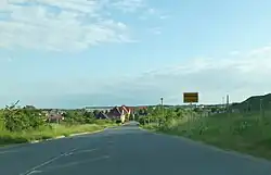 | |
Location of Menteroda | |
 Menteroda  Menteroda | |
| Coordinates: 51°17′N 10°33′E / 51.283°N 10.550°E | |
| Country | Germany |
| State | Thuringia |
| District | Unstrut-Hainich-Kreis |
| Municipality | Unstruttal |
| Area | |
• Total | 27.35 km2 (10.56 sq mi) |
| Elevation | 431 m (1,414 ft) |
| Population (2021-12-31) | |
• Total | 1,863 |
| • Density | 68/km2 (180/sq mi) |
| Time zone | UTC+01:00 (CET) |
| • Summer (DST) | UTC+02:00 (CEST) |
| Postal codes | 99996 |
| Dialling codes | 036029 |
| Website | www.menteroda.de |
Menteroda (German pronunciation: [mɛntəˈʁoːda]) is a village and a former municipality in the Unstrut-Hainich-Kreis district of Thuringia, Germany. On 1 January 2023 it became part of the municipality Unstruttal.[1]
History
Within the German Empire (1870-1918), Menteroda was part of the Duchy of Saxe-Coburg and Gotha.
References
- ^ "Thüringer Gesetz- und Verordnungsblatt Nr. 26/2022" (PDF). 20 December 2022. p. 475.
External links
 Media related to Menteroda at Wikimedia Commons