Merksplas
Merksplas | |
|---|---|
 | |
 Flag  Coat of arms | |
Location of Merksplas | |
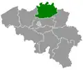
 Merksplas Location in Belgium
Location of Merksplas in the province of Antwerp 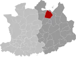 | |
| Coordinates: 51°22′N 04°52′E / 51.367°N 4.867°E | |
| Country | Belgium |
| Community | Flemish Community |
| Region | Flemish Region |
| Province | |
| Arrondissement | Turnhout |
| Government | |
| • Mayor | Frank Wilrycx |
| • Governing party/ies | LM (Leefbaar Merksplas) |
| Area | |
• Total | 44.61 km2 (17.22 sq mi) |
| Population (2020-01-01)[1] | |
• Total | 8,588 |
| • Density | 190/km2 (500/sq mi) |
| Postal codes | 2330 |
| NIS code | 13023 |
| Area codes | 014, 03 |
| Website | www.merksplas.be |
Merksplas (Dutch pronunciation: [ˈmɛr(ə)ksplɑs]) is a municipality located in the Belgian province of Antwerp. The municipality comprises only the town of Merksplas proper. In 2021, Merksplas had a total population of 8,616.[2] The total area is 44.56 km2.
References
- ^ "Bevolking per gemeente op 1 januari 2020". Statbel.
- ^ "Bevolking per statistische sector - Sector 12030D". Statistics Belgium. Retrieved 10 May 2022.
External links
 Media related to Merksplas at Wikimedia Commons
- Official website - Available only in Dutch
Places adjacent to Merksplas | ||||||||||||||||
|---|---|---|---|---|---|---|---|---|---|---|---|---|---|---|---|---|
| ||||||||||||||||