Microregion of Frederico Westphalen
Frederico Westphalen | |
|---|---|
 | |
| Country | Brazil |
| State | Rio Grande do Sul |
| Mesoregion | Noroeste Rio-Grandense |
| Municipalities | 27 |
| Area | |
• Total | 5,182.529 km2 (2,000.986 sq mi) |
| Population (2005) | |
• Total | 175,391 |
| • Density | 34/km2 (88/sq mi) |
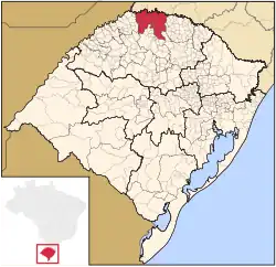
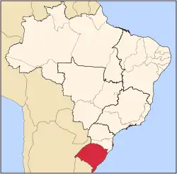
The Microregion of Frederico Westphalen (Brazilian Portuguese: Microrregião de Frederico Westphalen) was one of the Microregions of the Rio Grande do Sul state, in Brazil. It belonged to the mesoregion of the Noroeste Rio-Grandense.[1] Its population was estimated by the IBGE to be of 175,391 in 2005, divided in 27 municipalities. Its total area is 5,182.529 km². The IBGE has since discontinued the microregion system for population tracking, replacing it with the term "immediate geographic region" (Brazilian Portuguese: Região geográfica imediata).[2]
Municipalities
- Alpestre
- Ametista do Sul
- Caiçara
- Constantina
- Cristal do Sul
- Dois Irmãos das Missões
- Engenho Velho
- Erval Seco
- Frederico Westphalen
- Gramado dos Loureiros
- Iraí
- Liberato Salzano
- Nonoai
- Novo Tiradentes
- Novo Xingu
- Palmitinho
- Pinheirinho do Vale
- Planalto
- Rio dos Índios
- Rodeio Bonito
- Rondinha
- Seberi
- Taquaruçu do Sul
- Três Palmeiras
- Trindade do Sul
- Vicente Dutra
- Vista Alegre do Prata
References
- ^ "Divisão regional do Brasil em mesorregiões e microrregiões geográficas" [Regional division of Brazil in geographic mesoregions and microregions] (PDF). Biblioteca IBGE (in Portuguese). 1. Instituto Brasileiro de Geografia e Estatística (IBGE): 117–124. Archived from the original (PDF) on 2018-11-02.
- ^ "Divisão Regional do Brasil" [Regional Division of Brazil] (in Brazilian Portuguese). Instituto Brasileiro de Geografia e Estatística (IBGE). 2017. Archived from the original on 2019-02-11. Retrieved 2020-02-18.
27°21′32″S 53°23′38″W / 27.3589°S 53.3939°W