Millers Lake, Michigan
Millers Lake, Michigan | |
|---|---|
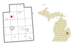 Location within Lapeer County | |
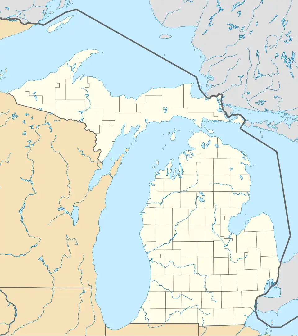 Millers Lake Location within the state of Michigan  Millers Lake Location within the United States | |
| Coordinates: 43°10′46″N 83°19′26″W / 43.17944°N 83.32389°W | |
| Country | United States |
| State | Michigan |
| County | Lapeer |
| Township | Deerfield |
| Area | |
• Total | 1.63 sq mi (4.23 km2) |
| • Land | 1.51 sq mi (3.91 km2) |
| • Water | 0.13 sq mi (0.32 km2) |
| Elevation | 805 ft (245 m) |
| Population (2020) | |
• Total | 311 |
| • Density | 205.96/sq mi (79.55/km2) |
| Time zone | UTC-5 (Eastern (EST)) |
| • Summer (DST) | UTC-4 (EDT) |
| ZIP code(s) | 48421 (Columbiaville) |
| Area code | 810 |
| FIPS code | 26-54132 |
| GNIS feature ID | 2804671[2] |
Millers Lake is a census-designated place (CDP) in the northwest part of Deerfield Township, Lapeer County, Michigan, United States, surrounding a lake of the same name. It is bordered to the east by the CDP of Barnes Lake. M-24 forms the border between the two CDPs; the state highway leads north 12 miles (19 km) to Mayville and south 9 miles (14 km) to Lapeer.
Millers Lake was first listed as a CDP prior to the 2020 census.[2] Previously, the community was part of the Barnes Lake-Millers Lake CDP.
Demographics
| Census | Pop. | Note | %± |
|---|---|---|---|
| 2020 | 311 | — | |
| U.S. Decennial Census[3] | |||
References
- ^ "2020 U.S. Gazetteer Files". United States Census Bureau. Retrieved May 21, 2022.
- ^ a b c U.S. Geological Survey Geographic Names Information System: Millers Lake Census Designated Place
- ^ "Census of Population and Housing". Census.gov. Retrieved June 4, 2016.
Municipalities and communities of Lapeer County, Michigan, United States | ||
|---|---|---|
| Cities |  | |
| Villages | ||
| Civil townships | ||
| CDPs |
| |
| Other communities | ||
| Footnotes | ‡This populated place also has portions in an adjacent county or counties | |