Missé
Missé | |
|---|---|
Part of Thouars | |
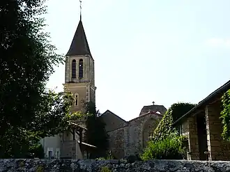 The church in Missé | |
Location of Missé | |
 Missé  Missé | |
| Coordinates: 46°56′58″N 0°11′27″W / 46.9494°N 0.1908°W | |
| Country | France |
| Region | Nouvelle-Aquitaine |
| Department | Deux-Sèvres |
| Arrondissement | Bressuire |
| Canton | Thouars |
| Commune | Thouars |
Area 1 | 12.34 km2 (4.76 sq mi) |
| Population (2022)[1] | 849 |
| • Density | 69/km2 (180/sq mi) |
| Time zone | UTC+01:00 (CET) |
| • Summer (DST) | UTC+02:00 (CEST) |
| Postal code | 79100 |
| Elevation | 47–117 m (154–384 ft) (avg. 106 m or 348 ft) |
| 1 French Land Register data, which excludes lakes, ponds, glaciers > 1 km2 (0.386 sq mi or 247 acres) and river estuaries. | |
Missé (French pronunciation: [mise]) is a former commune in the Deux-Sèvres department in western France. On 1 January 2019, it was merged into the commune Thouars.[2]
It is situated on the river Thouet some 5 km upstream from the town of Thouars, and is the site of a spectacular loop in the river.[3]
See also
References
- ^ "Populations de référence 2022" [Reference populations 2022] (PDF) (in French). INSEE. December 2024.
- ^ Arrêté préfectoral 30 October 2018 (in French)
- ^ "France for Walkers - The Thouet Valley". France Magazine. Archived from the original on July 11, 2011. Retrieved 2008-06-04.
Wikimedia Commons has media related to Missé.