Moa River
| Moa | |
|---|---|
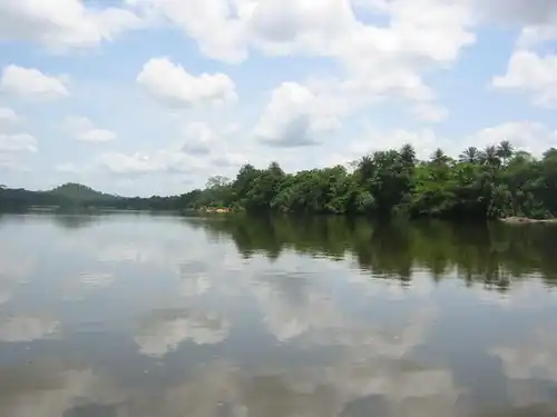 Tiwai Island on the Moa River | |
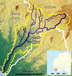 Map of the Moa River Basin | |
| Location | |
| Countries | |
| Physical characteristics | |
| Source | |
| • location | Guinea Highlands, Guinea |
| • elevation | 930 m (3,050 ft) |
| Mouth | |
• location | Atlantic Ocean |
| Length | 475 km (295 mi)[1] |
| Basin size | 19,560 km2 (7,550 sq mi)[2] |
| Discharge | |
| • location | Near mouth |
| • average | (Period: 1979–2015) 32.94 km3/a (1,044 m3/s)[2] |
| Basin features | |
| River system | Moa River |
| Tributaries | |
| • left | Ouaou, Mauwa |
| • right | Mafissa, Meli, Male |
The Moa River (Makona River)[3] is a river in West Africa. It arises in the highlands of Guinea and flows southwest, forming parts of the Guinea–Liberia and the Guinea – Sierra Leone borders. It flows into the Southern Province of Sierra Leone.[3] Yenga, Tiwai Island and Sulima are located on the Moa.
Notes
- ^ "North Africa-West Coast". Archived from the original on 2024-01-29. Retrieved 2024-01-29.
- ^ a b "River Basins". Archived from the original on 2024-01-17. Retrieved 2024-01-29.
- ^ a b Johnston, Harry (1911). . In Chisholm, Hugh (ed.). Encyclopædia Britannica. Vol. 16 (11th ed.). Cambridge University Press. p. 539.
7°01′09″N 11°32′29″W / 7.0192°N 11.5413°W