Molena, Georgia
Molena, Georgia | |
|---|---|
 Molena City Hall | |
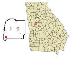 Location in Pike County and the state of Georgia | |
| Coordinates: 33°0′35″N 84°30′8″W / 33.00972°N 84.50222°W | |
| Country | United States |
| State | Georgia |
| County | Pike |
| Area | |
• Total | 1.89 sq mi (4.89 km2) |
| • Land | 1.87 sq mi (4.85 km2) |
| • Water | 0.01 sq mi (0.04 km2) |
| Elevation | 768 ft (234 m) |
| Population (2020) | |
• Total | 392 |
| • Density | 209.40/sq mi (80.83/km2) |
| Time zone | UTC-5 (Eastern (EST)) |
| • Summer (DST) | UTC-4 (EDT) |
| ZIP code | 30258 |
| Area code | 770 |
| FIPS code | 13-52108[2] |
| GNIS feature ID | 0318384[3] |
Molena is a city in Pike County, Georgia, United States. The population was 392 in 2020.[4]
History
Early variant names were "Snidersville" and "Jenkinsville".[5] The Georgia General Assembly incorporated Molena as a city in 1905.[6]
Geography
Molena is located at 33°0′35″N 84°30′8″W / 33.00972°N 84.50222°W (33.009860, -84.502152).[7]
According to the United States Census Bureau, the city has a total area of 1.7 square miles (4.4 km2), all land.
Demographics
| Census | Pop. | Note | %± |
|---|---|---|---|
| 1890 | 198 | — | |
| 1900 | 394 | 99.0% | |
| 1910 | 398 | 1.0% | |
| 1920 | 411 | 3.3% | |
| 1930 | 447 | 8.8% | |
| 1940 | 310 | −30.6% | |
| 1950 | 307 | −1.0% | |
| 1960 | 279 | −9.1% | |
| 1970 | 389 | 39.4% | |
| 1980 | 379 | −2.6% | |
| 1990 | 439 | 15.8% | |
| 2000 | 475 | 8.2% | |
| 2010 | 368 | −22.5% | |
| 2020 | 392 | 6.5% | |
| U.S. Decennial Census[8] | |||
As of the census[2] of 2000, there were 475 people, 134 households, and 110 families residing in the city. By 2020, there were 392 people in the city.[4]
Education
The Public Schools in Molena are part of the Pike County School District. The district includes a pre-kindergarten to second-grade building, an elementary school, a middle school, a ninth-grade academy, and a high school.
References
- ^ "2020 U.S. Gazetteer Files". United States Census Bureau. Retrieved December 18, 2021.
- ^ a b "U.S. Census website". United States Census Bureau. Retrieved January 31, 2008.
- ^ "US Board on Geographic Names". United States Geological Survey. October 25, 2007. Retrieved January 31, 2008.
- ^ a b "Explore Census Data". data.census.gov. Retrieved July 27, 2024.
- ^ Krakow, Kenneth K. (1975). Georgia Place-Names: Their History and Origins (PDF). Macon, GA: Winship Press. p. 149. ISBN 0-915430-00-2.
- ^ Acts and Resolutions of the General Assembly of the State of Georgia. Clark & Hines, State Printers. 1905. p. 1018.
- ^ "US Gazetteer files: 2010, 2000, and 1990". United States Census Bureau. February 12, 2011. Retrieved April 23, 2011.
- ^ "Census of Population and Housing". Census.gov. Retrieved June 4, 2015.
Municipalities and communities of Pike County, Georgia, United States | ||
|---|---|---|
| Cities |  | |
| Towns | ||
| CDP | ||
| Unincorporated communities | ||