Mont Mallet
| Mont Mallet | |
|---|---|
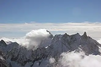 From left: Grandes Jorasses (behind cloud), Dôme de Rochefort, Mont Mallet, Aiguille de Rochefort and Dent du Géant. | |
| Highest point | |
| Elevation | 3,989 m (13,087 ft) |
| Coordinates | 45°51′55″N 06°57′38″E / 45.86528°N 6.96056°E |
| Geography | |
 Mont Mallet France | |
| Location | Haute-Savoie, France |
| Parent range | Mont Blanc Massif |
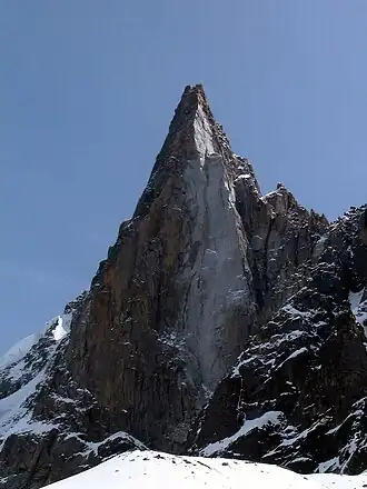
Mont Mallet (3,989 metres (13,087 ft)) is a mountain in the Mont Blanc massif in Haute-Savoie, France. It lies on a spur running northwards from the French-Italian frontier ridge, and can be most easily reached from the Aiguille de Rochefort.
Mont Mallet was first climbed on 4 September 1871. The first ascension party consisted of Leslie Stephen, Gabriel Loppé, F. Wallroth, Melchior Anderegg, Cachet and A. Tournier. They reached it via its southern ridge, a route now graded on the French adjectival climbing scale as PD. Its north ridge (graded AD) was first climbed in 1882.[1]