Montabaur Heights
| Montabaurer Höhe | |
|---|---|
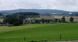 View over Vielbach by the | |
| Highest point | |
| Peak | Alarmstange |
| Elevation | 545.2 m (1,789 ft) |
| Dimensions | |
| Length | 12 km (7.5 mi) |
| Geography | |
| State(s) | near Montabaur; Westerwaldkreis, Rhineland-Palatinate, Germany |
| Range coordinates | 50°25′29.9″N 7°44′2″E / 50.424972°N 7.73389°E |
| Parent range | Lower Westerwald |
| Geology | |
| Orogeny | Mittelgebirge |
| Rock type | Quartzite |
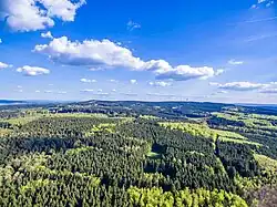
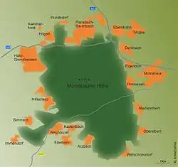
The Montabaur Heights (German: Montabaurer Höhe) are a 10 to 15 kilometre long, mostly wooded hill ridge in the southwestern Westerwald in Germany and lies mainly within the county of Westerwaldkreis. The ridge is geographically classified as sub-natural region 324.1 of the Lower Westerwald (major unit 324) and has its highest hill, the 545.2 m above sea level (NHN)[1] Alarmstange, whose summit rises six kilometres west of the town of Montabaur and about 12 km northeast of Koblenz.
Literature
- Mischa Ferdinand, Ursula Braun: Die Farnflora der Montabaurer Höhe, Zweckverb. Naturpark Nassau, 1997