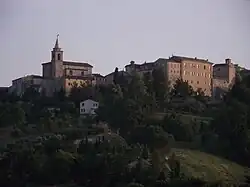
Monte Roberto
Monte Roberto | |
|---|---|
| Comune di Monte Roberto | |
 | |
Location of Monte Roberto | |
 Monte Roberto Location of Monte Roberto in Italy 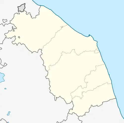 Monte Roberto Monte Roberto (Marche) | |
| Coordinates: 43°29′N 13°8′E / 43.483°N 13.133°E | |
| Country | Italy |
| Region | Marche |
| Province | Ancona (AN) |
| Government | |
| • Mayor | Gabriele Giampaoletti |
| Area | |
• Total | 13.51 km2 (5.22 sq mi) |
| Elevation | 348 m (1,142 ft) |
| Population (30 November 2017)[2] | |
• Total | 3,097 |
| • Density | 230/km2 (590/sq mi) |
| Demonym | Monterobertesi |
| Time zone | UTC+1 (CET) |
| • Summer (DST) | UTC+2 (CEST) |
| Postal code | 60030 |
| Dialing code | 0731 |
| Patron saint | St. Sylvester |
| Saint day | 31 December |
| Website | Official website |
Monte Roberto is a comune (municipality) in the Province of Ancona in the Italian region Marche, located about 35 kilometres (22 mi) southwest of Ancona.
Monte Roberto borders the following municipalities: Castelbellino, Cupramontana, Jesi, Maiolati Spontini, San Paolo di Jesi.
Twin towns
References
- ^ "Superficie di Comuni Province e Regioni italiane al 9 ottobre 2011". Italian National Institute of Statistics. Retrieved 16 March 2019.
- ^ All demographics and other statistics: Italian statistical institute Istat.