Montferrand, Aude
Montferrand | |
|---|---|
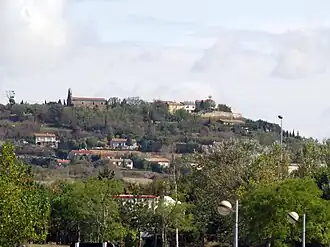 A general view of Montferrand | |
.svg.png) Coat of arms | |
Location of Montferrand | |
 Montferrand  Montferrand | |
| Coordinates: 43°21′55″N 1°49′12″E / 43.3653°N 1.82°E | |
| Country | France |
| Region | Occitania |
| Department | Aude |
| Arrondissement | Carcassonne |
| Canton | Le Bassin chaurien |
| Government | |
| • Mayor (2020–2026) | Christophe Pradel[1] |
Area 1 | 17.93 km2 (6.92 sq mi) |
| Population (2022)[2] | 648 |
| • Density | 36/km2 (94/sq mi) |
| Time zone | UTC+01:00 (CET) |
| • Summer (DST) | UTC+02:00 (CEST) |
| INSEE/Postal code | 11243 /11320 |
| Elevation | 186–301 m (610–988 ft) (avg. 193 m or 633 ft) |
| 1 French Land Register data, which excludes lakes, ponds, glaciers > 1 km2 (0.386 sq mi or 247 acres) and river estuaries. | |
Montferrand (French pronunciation: [mɔ̃fɛʁɑ̃] ⓘ) is a commune in the Aude department in southern France.
Population
| Year | Pop. | ±% |
|---|---|---|
| 1962 | 396 | — |
| 1968 | 438 | +10.6% |
| 1975 | 395 | −9.8% |
| 1982 | 352 | −10.9% |
| 1990 | 356 | +1.1% |
| 1999 | 410 | +15.2% |
| 2008 | 486 | +18.5% |
See also
References
- ^ "Répertoire national des élus: les maires". data.gouv.fr, Plateforme ouverte des données publiques françaises (in French). 2 December 2020.
- ^ "Populations de référence 2022" (in French). The National Institute of Statistics and Economic Studies. 19 December 2024.
Wikimedia Commons has media related to Montferrand, Aude.