Mount Gordon
| Mount Gordon | |
|---|---|
 Mount Gordon | |
| Highest point | |
| Elevation | 9,040 ft (2,760 m)[1][2][3] |
| Prominence | 2,018 ft (615 m)[3] |
| Listing | Volcanoes in the United States |
| Coordinates | 62°07′52″N 143°05′18″W / 62.1312°N 143.0883°W[2] |
| Geography | |
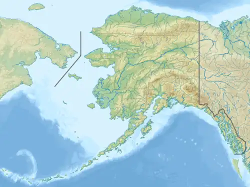 Mount Gordon Location in Alaska | |
| Location | Valdez-Cordova Census Area, Alaska, United States |
| Parent range | Wrangell Mountains[1] |
| Topo map | USGS Nabesna A-5 NE[4] |
| Geology | |
| Rock age | Pleistocene[5] |
| Mountain type | Cinder cone[1][5] |
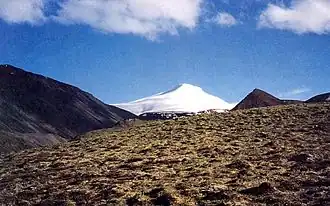
Mount Gordon is a cinder cone in the Wrangell Mountains of eastern Alaska, United States, located between Nabesna Glacier and the stratovolcano Mount Drum.[5] It is the most prominent of a group of Pleistocene and Holocene cinder cones, most of which are less than 100 m (330 ft) high. The exact age of Mount Gordon remains unknown. The mountain was named after a local prospector who was in the area in 1899.[2][4]
References
- ^ a b c Richter, Donald H.; Rosenkrans, Danny S.; Steigerwald, Margaret J. (1995). "Guide to the Volcanoes of the Western Wrangell Mountains, Alaska" (PDF). U.S. Geological Survey Bulletin 2072. U.S. Geological Survey. doi:10.3133/b2072.
- ^ a b c "Gordon". Alaska Volcano Observatory. Retrieved 2025-04-19.
- ^ a b "Mount Gordon, Alaska". Peakbagger.com. Retrieved 2025-04-19.
- ^ a b "Mount Gordon". Geographic Names Information System. United States Geological Survey, United States Department of the Interior. Retrieved 2025-04-19.
- ^ a b c "Gordon". Global Volcanism Program. Smithsonian Institution. Retrieved 2025-04-19.