Mount Kialagvik
| Mount Kialagvik | |
|---|---|
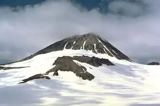 A photo of Mount Kialagvik, taken by T.P. Miller of the United States Geological Survey in July 1979.[1] | |
| Highest point | |
| Elevation | 5,167 ft (1,575 m)[2] |
| Prominence | 3,445 ft (1,050 m)[3] |
| Listing | List of volcanoes in the United States of America |
| Coordinates | 57°12′11″N 156°44′42″W / 57.203°N 156.745°W |
| Geography | |
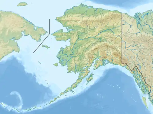 Mount Kialagvik Location in Alaska | |
| Location | Alaska Peninsula, Alaska, USA |
| Parent range | Aleutian Range |
| Topo map | USGS Ugashik A-3 |
| Geology | |
| Formed by | Subduction zone volcanism |
| Rock age | Holocene |
| Mountain type | Stratovolcano |
| Volcanic arc | Aleutian Arc |
| Last eruption | Unknown |
Mount Kialagvik is a small, poorly known stratovolcano on the Alaska Peninsula of Alaska, United States, located in the Aleutian Range about 10 miles (16 km) northeast of Mount Chiginagak.[4] It is informally named after the Iñupiaq word for nearby Wide Bay.[2] Kialagvik has not erupted in historic time.
See also
References
- ^ Alaska Volcano Observatory, AVO Image 13925: Kialagvik, Retrieved Jan. 6, 2023.
- ^ a b Alaska Volcano Observatory, Volcano Information -- Kialagvik, Retrieved Jan. 6, 2023.
- ^ Peakbagger.com, Mount Kialagvik, Alaska, Retrieved Jan. 6, 2023.
- ^ "Kialagvik". Global Volcanism Program. Smithsonian Institution. Retrieved 2021-06-28.