Mount Petegari
| Mount Petegari | |
|---|---|
| ペテガリ岳 | |
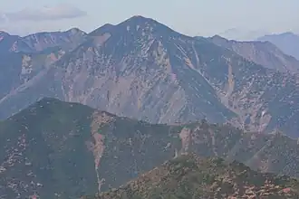 A view from Mount Kamui | |
| Highest point | |
| Elevation | 1,736.2 m (5,696 ft) |
| Listing | List of mountains and hills of Japan by height |
| Coordinates | 42°29′58″N 142°52′16″E / 42.49944°N 142.87111°E |
| Geography | |
| Location | Hokkaidō, Japan |
| Parent range | Hidaka Mountains |
| Topo map(s) | Geographical Survey Institute (国土地理院, Kokudochiriin) 25000:1 ビリガイ山, 25000:1 ヤオロマップ岳, 50000:1 神威岳 |
| Geology | |
| Mountain type | Fold |
Mount Petegari (ペテガリ岳, Petegari-dake) is located in the Hidaka Mountains, Hokkaidō, Japan.
References
- Google Maps
- Geographical Survey Institute
- Shyun Umezawa, Yasuhiko Sugawara, and Jun Nakagawa, Hokkaidō Natsuyama Gaido 4: Hidaka Sanmyaku no Yamayama (北海道夏山ガイド4日高山脈の山やま), Sapporo, Hokkaidō Shimbunshya, 1991. ISBN 4-89363-605-7