Mount Warrawolong
| Mount Warrawolong | |
|---|---|
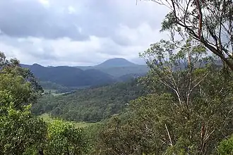
 Mount Warrawolong as viewed from Wattagan Creek Road, Laguna | |
| Highest point | |
| Elevation | 641 m (2,103 ft) AHD |
| Coordinates | 33°02′S 151°15′E / 33.033°S 151.250°E[1] |
| Geography | |
 Mount Warrawolong Location in New South Wales | |
| Country | Australia |
| State | New South Wales |
| Parent range | Watagan Mountains |
| Topo map | Morisset |
Mount Warrawolong is the highest point of the Watagan Mountains in New South Wales, Australia, rising to 641 metres (2,103 ft) above sea level.[2]
References
- ^ "Mount Warrawolong". Geographical Names Register (GNR) of NSW. Geographical Names Board of New South Wales. Retrieved 30 May 2015.
- ^ Greg Powell (2003). Hunter Valley Bushwalks. Kingsclear Books Pty Ltd. pp. 52–5. ISBN 978-0-908272-73-0.