Muckendorf-Wipfing
Muckendorf-Wipfing | |
|---|---|
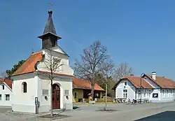 Chapel in Wipfing | |
 Coat of arms | |
 Muckendorf-Wipfing Location within Austria | |
| Coordinates: 48°19′47″N 16°09′04″E / 48.32972°N 16.15111°E | |
| Country | Austria |
| State | Lower Austria |
| District | Tulln |
| Government | |
| • Mayor | Hermann Grüssinger (WMW) |
| Area | |
• Total | 6.34 km2 (2.45 sq mi) |
| Elevation | 173 m (568 ft) |
| Population (2018-01-01)[2] | |
• Total | 1,573 |
| • Density | 250/km2 (640/sq mi) |
| Time zone | UTC+1 (CET) |
| • Summer (DST) | UTC+2 (CEST) |
| Postal code | 3426 |
| Area code | 02242 |
| Vehicle registration | TU |
| Website | www.muckendorf-wipfing.at |
Muckendorf-Wipfing is a municipality in the district of Tulln in the Austrian state of Lower Austria. On the south bank of the Danube, it is around 20 km northwest of Vienna.
Population
| Year | Pop. | ±% |
|---|---|---|
| 1971 | 699 | — |
| 1981 | 719 | +2.9% |
| 1991 | 886 | +23.2% |
| 2001 | 980 | +10.6% |
References
Wikimedia Commons has media related to Muckendorf-Wipfing.
- ^ "Dauersiedlungsraum der Gemeinden Politischen Bezirke und Bundesländer - Gebietsstand 1.1.2018". Statistics Austria. Retrieved 10 March 2019.
- ^ "Einwohnerzahl 1.1.2018 nach Gemeinden mit Status, Gebietsstand 1.1.2018". Statistics Austria. Retrieved 9 March 2019.