Néant-sur-Yvel
Néant-sur-Yvel
Neant | |
|---|---|
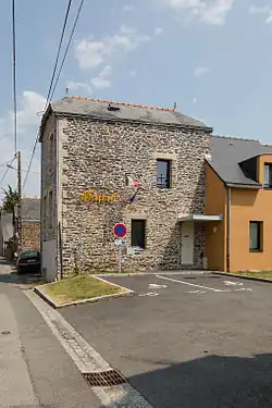 The town hall in Néant-sur-Yvel | |
.svg.png) Coat of arms | |
Location of Néant-sur-Yvel | |
 Néant-sur-Yvel  Néant-sur-Yvel | |
| Coordinates: 48°00′51″N 2°19′40″W / 48.0142°N 2.3278°W | |
| Country | France |
| Region | Brittany |
| Department | Morbihan |
| Arrondissement | Pontivy |
| Canton | Ploërmel |
| Intercommunality | Ploërmel Communauté |
| Government | |
| • Mayor (2020–2026) | Philippe Louapre[1] |
Area 1 | 32.30 km2 (12.47 sq mi) |
| Population (2022)[2] | 1,070 |
| • Density | 33/km2 (86/sq mi) |
| Time zone | UTC+01:00 (CET) |
| • Summer (DST) | UTC+02:00 (CEST) |
| INSEE/Postal code | 56145 /56430 |
| Elevation | 37–150 m (121–492 ft) |
| 1 French Land Register data, which excludes lakes, ponds, glaciers > 1 km2 (0.386 sq mi or 247 acres) and river estuaries. | |
Néant-sur-Yvel (French pronunciation: [neɑ̃ syʁ ivɛl]; Breton: Neant) is a commune in the Morbihan department of Brittany in north-western France.[3] The toponym refers to the river Yvel. Inhabitants of Néant-sur-Yvel are called in French Néantais.
See also
References
- ^ "Maires du Morbihan" (PDF). Préfecture du Morbihan. 7 July 2020.
- ^ "Populations de référence 2022" (in French). The National Institute of Statistics and Economic Studies. 19 December 2024.
- ^ INSEE commune file
External links
Wikimedia Commons has media related to Néant-sur-Yvel.
- Base Mérimée: Search for heritage in the commune, Ministère français de la Culture. (in French)
- Mayors of Morbihan Association (in French)