Al-Arishah Subdistrict
Al-Arishah Subdistrict
ناحية العريشة | |
|---|---|
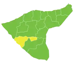 Location of Al-Arishah Subdistrict within al-Hasakah Governorate | |
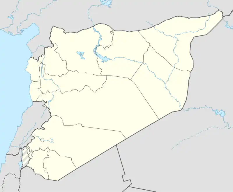 Al-Arishah Subdistrict Location in Syria | |
| Coordinates (al-Arishah): 36°13′27″N 40°29′23″E / 36.2242°N 40.4897°E | |
| Country | |
| Governorate | al-Hasakah |
| District | Al-Hasakah District |
| Seat | al-Arishah |
| Area | |
• Total | 1,519.41 km2 (586.65 sq mi) |
| Population (2004)[1] | 30,544 |
| Geocode | SY080005 |
Al-Arishah Subdistrict (Arabic: ناحية العريشة) is a subdistrict of al-Hasakah District in southern al-Hasakah Governorate, northeastern Syria. The Administrative centre is the town of al-Arishah. At the 2004 census, the subdistrict had a population of 30,544.[1]
Cities, towns and villages
| PCode | Name | Population |
|---|---|---|
| — | Bureij Sharqi | 4,160 |
| C4497 | al-Arishah | 3,957 |
| C4500 | al-Hajiyah | 3,643 |
| C4498 | al-Haddadiyah | 3,345 |
| C4502 | Umm Madfaa | 2,519 |
| C4505 | Manajid | 1,953 |
| C4496 | al-Gharb | 1,814 |
| — | Umm Raqibah Sharqiyah | 1,753 |
| — | Ajajah Sharqiyah | 1,441 |
| C4501 | al-Hamdaniyah | 1,377 |
| — | Qana | 838 |
| C4499 | Zayn al-Mabraj | 726 |
| — | ? | 684 |
| — | an-Nassiri | 600 |
| C4504 | Metiaha | 565 |
| — | ? | 424 |
| — | al-Malihah | 414 |
| C4495 | Ghuzaylan | 161 |
| C4503 | Umm Kheif | 103 |
| — | ? | 67 |
References
- ^ a b "2004 Census Data for Nahiya al-Arishah" (in Arabic). Syrian Central Bureau of Statistics. Archived from the original on 4 March 2016. Retrieved 15 October 2015. Also available in English: "2004 Census Data". UN OCHA. Retrieved 15 October 2015.