Nakka Khurd
Nakka Khurd
نکہ خُورد | |
|---|---|
Village | |
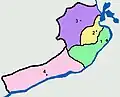
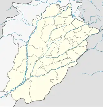 Nakka Khurd Location within Punjab, Pakistan 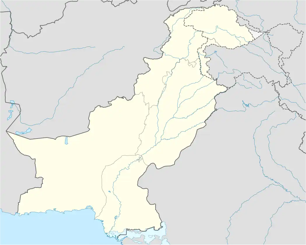 Nakka Khurd Nakka Khurd (Pakistan) | |
| Coordinates: 32°46′21.309″N 73°26′38.655″E / 32.77258583°N 73.44407083°E | |
| Country | Pakistan |
| Province | Punjab |
| District | Jhelum |
| Tehsil | Jhelum |
| Union Council | Nakka Khurd |
| Government | |
| • Type | Union Council |
| Elevation | 291 m (955 ft) |
| Population (2017)[1] | |
• Total | 868 |
• Estimate (2023) | 942 |
| Time zone | UTC+5 (PKT) |
Nakka Khurd (Urdu: نکہ خُورد), is a village in the Jhelum District of Punjab, Pakistan. Serving as the central hub for the Nakka Khurd union council within Jhelum Tehsil,[2] it is 14.72 kilometers northwest of Rasul and 13.32 kilometers north of Jalalpur Sharif.[3]
Etymology
Nakka is a Punjabi language term commonly associated with the eye of a needle,[4] suggesting a narrow gateway when applied geographically.[5] This connection might stem from the village's proximity to a narrow passage among mountains where Naalah Bunhan flows. Khurd is a term originating from the Persian language denoting small. Used administratively in both India and Pakistan, Khurd designates the smaller section of a town, village, or settlement, typically appended after place names. Consequently, the combined village name implies the meaning of a small gateway.[6]
Geography
Nakka Khurd is located in the southwestern part of Jhelum Tehsil, situated on the plateau between the Jhelum River and the Salt Range.[2]
Demographics
| Historical population | ||||
|---|---|---|---|---|
| Census | Pop. | Time span (yrs) | %± | Annual RoG %± |
| 1951 | 390 | — | — | — |
| 1961 | 409 | 10 | 4.87% | .48% |
| 1972 | 494 | 11 | 20.78% | 1.73% |
| 1981 | 502 | 9 | 1.62% | .18% |
| 1998 | 669 | 17 | 33.27% | 1.7% |
| 2017 | 868 | 19 | 29.75% | 1.38% |
| 2023 (est) | 942 | 6 | 8.53% | 1.38% |
| Sources[1][7][8] | ||||
References
- ^ a b "Jhelum District Population of Cities, Towns and Villages 2017-2018". PoliticsPK. Retrieved 26 December 2023.
- ^ a b "Tehsil Jhelum (Jhelum District) Street Guide and Map". Streets of Pakistan. Retrieved 26 December 2023.
- ^ "Distance". SunEarthTools.com. Retrieved 26 December 2023.
- ^ "Nakka". Wisdom Library. Retrieved 26 December 2023.
- ^ "Historical Sikh Events: Nakai Misl". All About Sikhs. Retrieved 26 December 2023.
- ^ "Celebrating Delhi". Ravi Dayal Publisher. Retrieved 26 December 2023.
- ^ "Population of Mauzas, 1951-81 Censuses". Population Census Organisation, Statistics Division, Government of Pakistan. 1987. Retrieved 26 December 2023. Page 22
- ^ "1998 District Census Report of Jhelum". Population Census Organisation, Statistics Division, Government of Pakistan. 1999. Retrieved 26 December 2023. Page 234