Nattages
Nattages | |
|---|---|
Part of Parves-et-Nattages | |
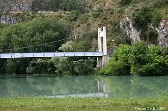 Suspension bridge over the Rhone | |
Location of Nattages | |
 Nattages  Nattages | |
| Coordinates: 45°44′00″N 5°46′00″E / 45.7333°N 5.7667°E | |
| Country | France |
| Region | Auvergne-Rhône-Alpes |
| Department | Ain |
| Arrondissement | Belley |
| Canton | Belley |
| Commune | Parves-et-Nattages |
Area 1 | 10.33 km2 (3.99 sq mi) |
| Population (2022)[1] | 587 |
| • Density | 57/km2 (150/sq mi) |
| Time zone | UTC+01:00 (CET) |
| • Summer (DST) | UTC+02:00 (CEST) |
| Postal code | 01300 |
| Elevation | 220–663 m (722–2,175 ft) (avg. 310 m or 1,020 ft) |
| 1 French Land Register data, which excludes lakes, ponds, glaciers > 1 km2 (0.386 sq mi or 247 acres) and river estuaries. | |
Nattages (French pronunciation: [nataʒ]) is a former commune in the Ain department in eastern France. On 1 January 2016, it was merged into the new commune Parves-et-Nattages.[2]
It contains the ruins of the Chateau Montbel, the romanesque chapel of Chemillieu and a church rebuilt in the 17th century.
Population
| Year | Pop. | ±% p.a. |
|---|---|---|
| 2006 | 528 | — |
| 2011 | 574 | +1.68% |
| 2022 | 587 | +0.20% |
| Source: INSEE[3][1] | ||
See also
References
- ^ a b "Populations de référence 2022" [Reference populations 2022] (PDF) (in French). INSEE. December 2024.
- ^ Arrêté préfectoral Archived 2016-03-17 at the Wayback Machine 24 December 2015 (in French)
- ^ Populations légales 2011, INSEE
Wikimedia Commons has media related to Nattages.