Uckerland
Uckerland | |
|---|---|
 Coat of arms | |
Location of Uckerland within Uckermark district 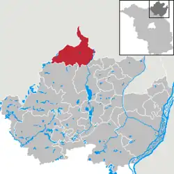 | |
 Uckerland  Uckerland | |
| Coordinates: 53°27′N 13°48′E / 53.450°N 13.800°E | |
| Country | Germany |
| State | Brandenburg |
| District | Uckermark |
| Subdivisions | 11 Ortsteile |
| Government | |
| • Mayor (2016–24) | Matthias Schilling[1] (SPD) |
| Area | |
• Total | 166.19 km2 (64.17 sq mi) |
| Elevation | 82 m (269 ft) |
| Population (2023-12-31)[2] | |
• Total | 2,448 |
| • Density | 15/km2 (38/sq mi) |
| Time zone | UTC+01:00 (CET) |
| • Summer (DST) | UTC+02:00 (CEST) |
| Postal codes | 17337 |
| Dialling codes | 039745, 039753, 039752 |
| Vehicle registration | UM |
| Website | www.uckerland.de |
Uckerland (German pronunciation: [ˈʊkɐˌlant]) is a municipality in the Uckermark district, in Brandenburg, Germany.
Demography
-
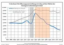 Development of population since 1875 within the current Boundaries (Blue Line: Population; Dotted Line: Comparison to Population development in Brandenburg state; Grey Background: Time of Nazi Germany; Red Background: Time of communist East Germany)
 -
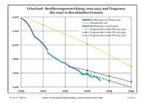 Recent Population Development and Projections (Population Development before Census 2011 (blue line); Recent Population Development according to the Census in Germany in 2011 (blue bordered line); Official projections for 2005-2030 (yellow line); for 2017-2030 (scarlet line); for 2020-2030 (green line)
|
|
|
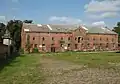
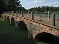
Photogallery
- Wolfshagen
-
 Church
 -
-
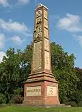
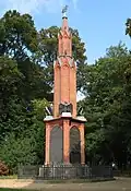 Napoleonic War memorial
 -
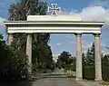 Gate
Gate -
 Storehouse
 -
References
- ^ Landkreis Uckermark Wahl der Bürgermeisterin / des Bürgermeisters, accessed 4 July 2021.
- ^ "Bevölkerungsstand im Land Brandenburg Dezember 2023] (Fortgeschriebene amtliche Einwohnerzahlen, basierend auf dem Zensus 2022)". Amt für Statistik Berlin-Brandenburglanguage=German.
- ^ Detailed data sources are to be found in the Wikimedia Commons.Population Projection Brandenburg at Wikimedia Commons
Towns and municipalities in Uckermark | ||
|---|---|---|
|  | |