New Lancaster, Kansas
New Lancaster, Kansas | |
|---|---|
 General Store (2020) | |
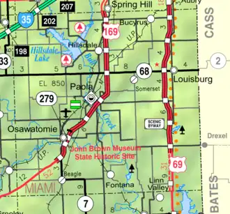 KDOT map of Miami County (legend) | |
 New Lancaster  New Lancaster | |
| Coordinates: 38°27′45″N 94°43′59″W / 38.46250°N 94.73306°W[1] | |
| Country | United States |
| State | Kansas |
| County | Miami |
| Elevation | 955 ft (291 m) |
| Time zone | UTC-6 (CST) |
| • Summer (DST) | UTC-5 (CDT) |
| Area code | 913 |
| FIPS code | 20-50375 |
| GNIS ID | 477646[1] |
New Lancaster is an unincorporated community in Miami County, Kansas, United States.[1] It is part of the Kansas City metropolitan area.[2]
History
A post office was opened in New Lancaster in 1859, and remained in operation until it was discontinued in 1906.[3]
New Lancaster General store is the oldest continuing shop in Miami County.
References
- ^ a b c d U.S. Geological Survey Geographic Names Information System: New Lancaster, Kansas
- ^ "Population Data and Maps | MARC".
- ^ "Kansas Post Offices, 1828-1961 (archived)". Kansas Historical Society. Archived from the original on October 9, 2013. Retrieved June 15, 2014.
Further reading
External links
Wikimedia Commons has media related to New Lancaster, Kansas.
Municipalities and communities of Miami County, Kansas, United States | ||
|---|---|---|
| Cities |  | |
| CDPs | ||
| Unincorporated communities | ||
| Townships |
| |
| Footnotes | ‡This community also has portions in an adjacent county or counties. | |