Nova Scotia Trunk 14
 Trunk 14 | ||||
|---|---|---|---|---|
| Route information | ||||
| Maintained by Nova Scotia Department of Transportation and Infrastructure Renewal | ||||
| Length | 120.7 km[1] (75.0 mi) | |||
| Major junctions | ||||
| West end | ||||
| ||||
| East end | ||||
| Location | ||||
| Country | Canada | |||
| Province | Nova Scotia | |||
| Counties | Hants, Lunenburg | |||
| Towns | Windsor | |||
| Highway system | ||||
| ||||
Trunk 14 is part of the Canadian province of Nova Scotia's system of Trunk Highways. The route runs from Chester to Milford Station through the Windsor area, for a distance of 121 kilometres (75 mi).[1]
Route description

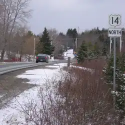
From a junction with Trunk 3 and Highway 103 in Chester, Trunk 14 runs north along the Windsor Road to Sherwood beside Card Lake, then northeast through Vaughan and Martock to a junction with Trunk 1 at Currys Corner, in Windsor.[2]
Trunk 14 follows Route 1 for a short distance to Garlands Crossing, where Trunk 14 branches off to the east. The route continues through the village of Brooklyn (running concurrently with Route 215 for a short distance) and then proceeds through the Rawdon region, turning southeast along the Nine Mile River to Lower Nine Mile River, where it turns eastward to its end at a junction with Trunk 2 and Highway 102 at Milford Station in the Musquodoboit Valley region.[2]
Major intersections
| County | Location | km[1] | mi | Destinations | Notes |
|---|---|---|---|---|---|
| Lunenburg | Chester | 0.0 | 0.0 | Western terminus | |
| 1.2 | 0.75 | Hwy 103 exit 8 | |||
| Hants | Windsor | 52.4 | 32.6 | West end of Trunk 1 concurrency | |
| Garlands Crossing | 54.2 | 33.7 | East end of Trunk 1 concurrency | ||
| | 55.2 | 34.3 | Hwy 101 exit 5 | ||
| Brooklyn | 64.0 | 39.8 | West end of Route 215 concurrency; Route 215 heads southeast but signed west[3] | ||
| 54.2 | 33.7 | West end of Route 215 concurrency; Route 215 heads northwest but signed east[4] | |||
| Centre Rawdon | 80.8 | 50.2 | |||
| Upper Rawdon | 93.1 | 57.8 | |||
| | 98.2 | 61.0 | |||
| Lower Nine Mile River | 110.3 | 68.5 | |||
| Milford Station | 119.9 | 74.5 | Hwy 101 exit 5 | ||
| 120.7 | 75.0 | Eastern terminus | |||
1.000 mi = 1.609 km; 1.000 km = 0.621 mi
| |||||
References
- ^ a b c "Nova Scotia Trunk 14" (Map). Google Maps. Retrieved March 12, 2020.
- ^ a b Nova Scotia Road Map (Map). 1:640,000. Province of Nova Scotia. 2019. §§ J-6, J-7, J-8, K-6, L-6.
- ^ Google (September 2018). "7829 Hwy 14 - Brooklyn, NS". Google Streetview. Retrieved March 12, 2020.
{{cite web}}:|author=has generic name (help) - ^ Google (September 2018). "7964 Hwy 14 - Brooklyn, NS". Google Streetview. Retrieved March 12, 2020.
{{cite web}}:|author=has generic name (help)
| 100-series | |
|---|---|
| Trunk routes | |
| Collector roads |
|
| Scenic routes | |