Ocoyoacac
Ocoyoacac | |
|---|---|
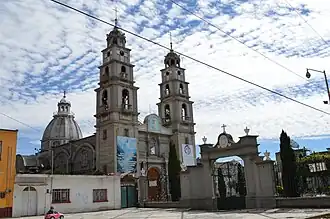 Santa Maria Church in Ocoyoacac | |
 Seal | |
 Ocoyoacac Location in Mexico | |
| Coordinates: 19°16′26″N 99°27′38″W / 19.27389°N 99.46056°W | |
| Country | |
| State | Mexico |
| Municipal Seat | Ocoyoacac |
| Area | |
| 134.71 km2 (52.01 sq mi) | |
| Elevation at seat | 2,620 m (8,600 ft) |
| Population (2010) | |
| 61,805 | |
| • Urban | 48,605 |
| Time zone | UTC-6 (Central Standard Time) |
Ocoyoacac is a municipality in the State of Mexico in Mexico. The municipal seat is the town of Ocoyoacac. The municipality covers an area of 134.71 km². It is one of the 17 municipalities that border Mexico City. It borders the Distrito Federal's western borough of Cuajimalpa.
As of the 2010 census, the municipality had a total population of 61,805 inhabitants.
Towns and Villages
The largest localities (cities, towns, and villages) are:[1]
| Name | 2010 Census Population |
|---|---|
| Ocoyoacac | 26,015 |
| San Pedro Cholula | 8,941 |
| San Jerónimo Acazulco | 4,827 |
| El Pedregal de Guadalupe Hidalgo | 4,534 |
| San Pedro Atlapulco | 4,288 |
| Colonia Juárez (Los Chirinos) | 1,300 |
| El Llano del Compromiso | 1,174 |
| Loma Bonita | 1,146 |
| Colonia el Pirame | 1,144 |
| San Antonio el Llanito | 1,102 |
| La Marquesa | 981 |
| Loma de los Esquiveles | 923 |
| Total Municipality | 61,805 |
See also
References
- ^ 2010 census tables: INEGI Archived 2013-05-02 at the Wayback Machine
External links
 Media related to Ocoyoacac Municipality at Wikimedia Commons