Om (river)
| Om Омь | |
|---|---|
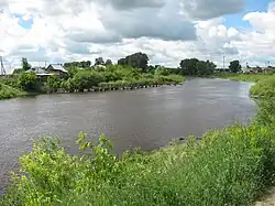 The Om in Kuybyshev | |
| Location | |
| Country | Russia |
| Physical characteristics | |
| Mouth | Irtysh |
• coordinates | 54°58′54″N 73°22′10″E / 54.9817°N 73.3694°E |
| Length | 1,091 km (678 mi) |
| Basin size | 52,600 km2 (20,300 sq mi) |
| Discharge | |
| • average | 64 m3/s (2,300 cu ft/s) 121 km from the mouth |
| Basin features | |
| Progression | Irtysh→ Ob→ Kara Sea |
The Om (Russian: Омь, Siberian Tatar: Ом[1]) is a river in the south of the Western Siberian plains in Russia. It is a right tributary of the Irtysh. It is 1,091 kilometres (678 mi) long, and has a drainage basin of 52,600 square kilometres (20,300 sq mi).[2]
The name is probably from the word om "quiet" in the language of the Baraba Tatars.[3]
Course
The Om rises in the Vasyugan Swamp at the border of Novosibirsk and Tomsk oblasts. It flows mainly across the Baraba Lowland of the West Siberian Plain.[4] The city of Omsk is situated at the confluence of Om and Irtysh, and Ust-Tarka at the confluence of the Om and the Tarka rivers. The main tributaries are the Icha, Kama and Tartas.[4]
References
- ^ Известия Всесоюзного географического общества. 1959 г. С. 253.
- ^ "Река ОМЬ in the State Water Register of Russia". textual.ru (in Russian).
- ^ E.M. Pospelov, Geograficheskie nazvaniya mira (Moscow, 1998), p. 310.
- ^ a b Омь, Great Soviet Encyclopedia
Wikimedia Commons has media related to Om River.