Opaljenik
Opaljenik
Опаљеник | |
|---|---|
Village | |
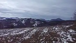 Landscape from top of Opaljenik in winter; Mountain Mučanj in the right corner | |
 Opaljenik | |
| Coordinates: 43°31′01″N 20°07′52″E / 43.51694°N 20.13111°E | |
| Country | |
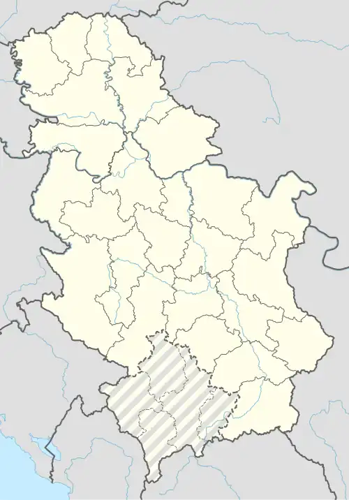
| District | Moravica District |
| Municipality | Ivanjica |
| Area | |
• Total | 20.42 km2 (7.88 sq mi) |
| Elevation | 718 m (2,356 ft) |
| Population (2011) | |
• Total | 219 |
| • Density | 11/km2 (28/sq mi) |
| Time zone | UTC+1 (CET) |
| • Summer (DST) | UTC+2 (CEST) |
| Postal code | 32258 |
| Area code | +381(0)32 |
| Vehicle registration | IC |
Opaljenik (Serbian Cyrillic: Опаљеник) is a village located in the municipality of Ivanjica, southwestern Serbia. According to the 2011 census, the village has a population of 219 inhabitants.[2]
References
- ^ "Насеља општине Ивањица" (PDF). stat.gov.rs (in Serbian). Statistical Office of Serbia. Archived from the original (PDF) on 14 November 2015. Retrieved 12 October 2019.
- ^ "2011 Census of Population, Households and Dwellings in the Republic of Serbia" (PDF). stat.gov.rs. Statistical Office of the Republic of Serbia. Retrieved 11 December 2017.
| Towns/Villages |
|  |
|---|---|---|
| Mountains | ||
| Culture | ||
| Religious monuments | ||
| Notable people | ||