Orleans, California
Orleans
Panamnik | |
|---|---|
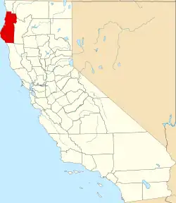
 Orleans Location in California  Orleans Orleans (the United States) | |
| Coordinates: 41°18′05″N 123°32′28″W / 41.30139°N 123.54111°W | |
| Country | United States |
| State | California |
| County | Humboldt County |
| Elevation | 404 ft (123 m) |
| ZIP code | 95556 |
| Area code | 530 |
| FIPS code | 06-54288 |
| GNIS feature ID | 264396 |
Orleans (formerly New Orleans Bar and Orleans Bar; Karuk: Panamnik)[2] is an unincorporated community in Humboldt County, California.[1] It is located 12 miles (19 km) northeast of Weitchpec along State Route 96 (the "Bigfoot Scenic Byway"), at an elevation of 404 feet (123 m).[3][1] Its ZIP Code is 95556.[4] It is within area code 530. The community is within the Six Rivers National Forest and contains a district ranger's office of the National Forest.
It is within the historical territory of the Karuk Tribe of California. The original indigenous settlement was named Panamnik. When European-American miners arrived, they named their settlement New Orleans Bar. It was renamed Orleans Bar in 1855 when it became the county seat of the now-defunct Klamath County, California.[3] The Orleans post office was established on December 2, 1857.[3]
Orleans is the nearest inhabited community to the site of the famous Patterson–Gimlin filming of a purported Bigfoot, which is in a remote area about 10 miles (16 km) northeast of Orleans.
Government
In the California State Legislature, Orleans is in the 2nd senatorial district, represented by Democrat Mike McGuire,[5] and the 2nd Assembly district, represented by Democrat Chris Rogers.[6]
In the United States House of Representatives, Orleans is in California's 2nd congressional district, represented by Democrat Jared Huffman.[7]
See also
Climate
Orleans has a Hot-summer Mediterranean climate (Csa) according to the Köppen climate classification system.
| Climate data for Orleans, California, 1991–2020 normals, extremes 1903–present | |||||||||||||
|---|---|---|---|---|---|---|---|---|---|---|---|---|---|
| Month | Jan | Feb | Mar | Apr | May | Jun | Jul | Aug | Sep | Oct | Nov | Dec | Year |
| Record high °F (°C) | 71 (22) |
83 (28) |
96 (36) |
101 (38) |
109 (43) |
111 (44) |
117 (47) |
116 (47) |
113 (45) |
102 (39) |
85 (29) |
72 (22) |
117 (47) |
| Mean maximum °F (°C) | 58.7 (14.8) |
66.4 (19.1) |
76.0 (24.4) |
84.6 (29.2) |
92.5 (33.6) |
98.3 (36.8) |
103.5 (39.7) |
101.9 (38.8) |
97.7 (36.5) |
83.7 (28.7) |
67.5 (19.7) |
58.3 (14.6) |
104.7 (40.4) |
| Mean daily maximum °F (°C) | 49.6 (9.8) |
54.9 (12.7) |
61.8 (16.6) |
68.3 (20.2) |
76.7 (24.8) |
83.1 (28.4) |
92.0 (33.3) |
91.0 (32.8) |
85.8 (29.9) |
70.9 (21.6) |
55.6 (13.1) |
47.9 (8.8) |
69.8 (21.0) |
| Daily mean °F (°C) | 43.4 (6.3) |
47.0 (8.3) |
51.4 (10.8) |
55.8 (13.2) |
62.3 (16.8) |
67.6 (19.8) |
74.4 (23.6) |
73.4 (23.0) |
68.7 (20.4) |
58.6 (14.8) |
48.8 (9.3) |
42.5 (5.8) |
57.8 (14.3) |
| Mean daily minimum °F (°C) | 37.3 (2.9) |
39.1 (3.9) |
41.0 (5.0) |
43.3 (6.3) |
47.9 (8.8) |
52.1 (11.2) |
56.8 (13.8) |
55.7 (13.2) |
51.5 (10.8) |
46.4 (8.0) |
41.9 (5.5) |
37.1 (2.8) |
45.8 (7.7) |
| Mean minimum °F (°C) | 27.4 (−2.6) |
29.9 (−1.2) |
32.6 (0.3) |
34.3 (1.3) |
39.6 (4.2) |
44.1 (6.7) |
48.9 (9.4) |
48.6 (9.2) |
44.0 (6.7) |
37.4 (3.0) |
31.5 (−0.3) |
28.3 (−2.1) |
24.2 (−4.3) |
| Record low °F (°C) | 9 (−13) |
16 (−9) |
22 (−6) |
25 (−4) |
20 (−7) |
33 (1) |
38 (3) |
39 (4) |
28 (−2) |
24 (−4) |
17 (−8) |
5 (−15) |
5 (−15) |
| Average precipitation inches (mm) | 9.39 (239) |
6.93 (176) |
6.38 (162) |
3.97 (101) |
2.25 (57) |
0.89 (23) |
0.19 (4.8) |
0.15 (3.8) |
0.76 (19) |
3.52 (89) |
6.81 (173) |
10.49 (266) |
51.73 (1,313.6) |
| Average snowfall inches (cm) | 0.1 (0.25) |
1.5 (3.8) |
0.2 (0.51) |
0.0 (0.0) |
0.0 (0.0) |
0.0 (0.0) |
0.0 (0.0) |
0.0 (0.0) |
0.0 (0.0) |
0.0 (0.0) |
0.0 (0.0) |
1.0 (2.5) |
2.8 (7.06) |
| Average precipitation days (≥ 0.01 in) | 15.7 | 13.8 | 15.0 | 11.5 | 7.7 | 3.4 | 1.0 | 1.2 | 2.1 | 6.6 | 13.9 | 17.1 | 109.0 |
| Average snowy days (≥ 0.1 in) | 0.4 | 0.6 | 0.4 | 0.0 | 0.0 | 0.0 | 0.0 | 0.0 | 0.0 | 0.0 | 0.0 | 0.8 | 2.2 |
| Source 1: NOAA[8] | |||||||||||||
| Source 2: National Weather Service[9] | |||||||||||||
References
- ^ a b c U.S. Geological Survey Geographic Names Information System: Orleans, California
- ^ Bright, William; Susan Gehr. "Karuk Dictionary and Texts". Retrieved July 6, 2012.
- ^ a b c Durham, David L. (1998). California's Geographic Names: A Gazetteer of Historic and Modern Names of the State. Clovis, California: Word Dancer Press. ISBN 1-884995-14-4.
- ^ USPS ZIP Code lookup tool Archived November 22, 2010, at the Wayback Machine
- ^ "Senators". State of California. Retrieved April 7, 2013.
- ^ "Members Assembly". State of California. Retrieved April 7, 2013.
- ^ "California's 2nd Congressional District - Representatives & District Map". Civic Impulse, LLC. Retrieved March 1, 2013.
- ^ "U.S. Climate Normals Quick Access – Station: Orleans, CA". National Oceanic and Atmospheric Administration. Retrieved May 6, 2023.
- ^ "NOAA Online Weather Data – NWS Eureka". National Weather Service. Retrieved May 6, 2023.
| Significant cities |  | |
|---|---|---|
| Major tributaries | ||
| Geography | ||
| Native American tribes | ||
| Dams and infrastructure | ||
41°18′05″N 123°32′28″W / 41.30139°N 123.54111°W