Píla, Pezinok District
Píla
Gidrafűrész | |
|---|---|
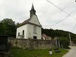 Church in Píla | |
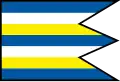 Flag | |
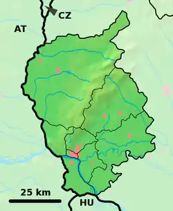 Píla Location of Píla in the Bratislava Region  Píla Location of Píla in Slovakia | |
| Coordinates: 48°23′N 17°20′E / 48.39°N 17.33°E | |
| Country | |
| Region | |
| District | Pezinok District |
| First mentioned | 1602 |
| Area | |
• Total | 0.48 km2 (0.19 sq mi) |
| Elevation | 244 m (801 ft) |
| Population (2021)[3] | |
• Total | 365 |
| Time zone | UTC+1 (CET) |
| • Summer (DST) | UTC+2 (CEST) |
| Postal code | 900 89[2] |
| Area code | +421 33[2] |
| Car plate | PK |
| Website | www |
Píla (Hungarian: Gidrafűrész, German: Sägmühl) is a village and municipality in western Slovakia in Pezinok District in the Bratislava region.
References
- ^ "Hustota obyvateľstva - obce [om7014rr_ukaz: Rozloha (Štvorcový meter)]". www.statistics.sk (in Slovak). Statistical Office of the Slovak Republic. 2022-03-31. Retrieved 2022-03-31.
- ^ a b c "Základná charakteristika". www.statistics.sk (in Slovak). Statistical Office of the Slovak Republic. 2015-04-17. Retrieved 2022-03-31.
- ^ "Počet obyvateľov podľa pohlavia - obce (ročne)". www.statistics.sk (in Slovak). Statistical Office of the Slovak Republic. 2022-03-31. Retrieved 2022-03-31.
External links
![]() Media related to Píla, Pezinok District at Wikimedia Commons
Media related to Píla, Pezinok District at Wikimedia Commons
Municipalities of Pezinok District | ||
|---|---|---|