Palauk
Palauk
ပလောက် | |
|---|---|
Town | |
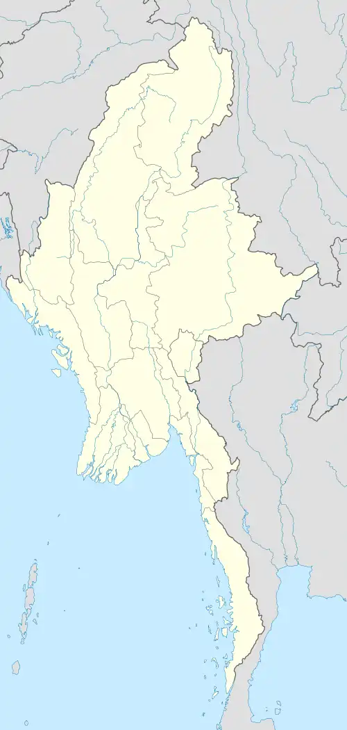 Palauk Location in Myanmar | |
| Coordinates: 13°15′44″N 98°37′53″E / 13.26222°N 98.63139°E | |
| Country | |
| Region | |
| District | Myeik |
| Township | Palaw |
| Area | |
• Total | 17.93 sq mi (46.4 km2) |
| Population (2019)[1] | |
• Total | 6,003 |
| • Density | 330/sq mi (130/km2) |
| Time zone | UTC+6.30 (MMT) |
Palauk[2] is a town in Palaw Township, Taninthayi Region, Myanmar. It is located on the main coastal road, Route 8, between Dawei and Palaw.[3] Palauk is the administrative seat of the Palauk Subtownship.
Administrative subdivisions
The administrative divisions of the Palauk Subtownship[4] are the following:
- Kyauklonegyi
- Pyichar
- Sinhtoegyi
- Nanthilar
- Pyinbugyi
External links
- "Palauk Map — Satellite Images of Lanywa" Maplandia World Gazetteer
References
- ^ Myanmar Information Management Unit (September 2019). Palaw Myone Daethasaingyarachatlatmya ပုလောမြို့နယ် ဒေသဆိုင်ရာအချက်လက်များ [Palaw Township Regional Information] (PDF) (Report). MIMU. Retrieved 12 February 2024.
- ^ Palauk at GEOnet Names Server, United States National Geospatial-Intelligence Agency
- ^ "General Logistics and Planning Map Myanmar" UNJLC Map Num:UNJLC-MM08a-002-A1, Myanmar Information Management Unit (MIMU), 8 May 2008
- ^ "Palaw Township, Tanintharyi, Myanmar" Archived 2011-07-22 at the Wayback Machine, Myanmar Information Management Unit (MIMU), 12 August 2010
Capital: Dawei | ||
| Dawei District |  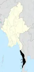 | |
| Myeik District | ||
| Bokepyin District |
| |
| Kawthaung District |
| |
| Main cities and towns | ||