Vicos
| Vicos | |
|---|---|
| Paccharuri | |
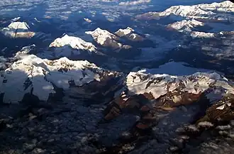 Aerial view of the Cordillera Blanca as seen from the east with Paccharuri in the upper part of the image (center-right) | |
| Highest point | |
| Elevation | 5,315 m (17,438 ft)[1] |
| Coordinates | 9°17′34″S 77°29′13″W / 9.29278°S 77.48694°W |
| Geography | |
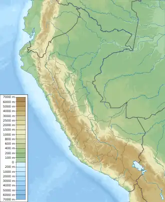 Vicos Peru | |
| Location | Ancash, Peru |
| Parent range | Andes, Cordillera Blanca |
| Climbing | |
| First ascent | 1952 Alberto Morales Arnap, A. Gamarra, J. Mariategui, J. Torres, L. Vidal[2] |
Vicos[3][1][4][5] or Paccharuri[6][2] (possibly from Ancash Quechua paqtsa waterfall, ruri inside; valley or little river)[7][8] is a 5,315 m (17,438 ft)[1][5] high mountain in the Cordillera Blanca in the Andes of Peru. It is situated in the Ancash Region, Carhuaz Province, Marcara District.[9] Paccharuri lies in the Huascarán National Park, southwest of Copa and southeast of Lake Lejiacocha.[1]
References
- ^ a b c d Peru 1:100 000, Huari (19-i). IGN (Instituto Geográfico Nacional - Perú).
- ^ a b "Nevado Paccharuri". Inventario Turistico del Perú. MINCETUR. Retrieved 2016-07-27.
- ^ "Vicos". www.montanasperuanas.com. Retrieved 2016-07-27.
- ^ Biggar, John (2005). The Andes: A Guide for Climbers. Andes. p. 78. ISBN 9780953608720.
- ^ a b Díaz, Felipe (2008–2009). Carta Turística. Cordilleras Blanca, Negra, Huayhuash y Callejón de Huaylas.
- ^ Neate, Jill (1994). "Peru". Mountaineering in the Andes (PDF). RGS-IBG Expedition Advisory Centre. ISBN 0-907649-64-5.
- ^ Robert Beér, Armando Muyolemaj, Dr. Hernán S. Aguilarpaj, Vocabulario comparativo, quechua ecuatoriano - quechua ancashino - castellano - English, Brighton 2006
- ^ Rubén Alejandro Mejía Méndez, Toponimia del Distrito de Yaután, Universidad Nacional Mayor de San Marcos, Lima, 2007
- ^ escale.minedu.gob.pe - UGEL map of the Carhuaz Province (Ancash Region)
Wikimedia Commons has media related to Cordillera Blanca.