Parpaillon massif
| Parpaillon Massif | |
|---|---|
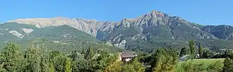 Parpaillon massif from Jausiers | |
| Highest point | |
| Elevation | 3,046 m (9,993 ft) |
| Parent peak | Grand Bérard |
| Coordinates | 44°29′12″N 6°38′12″E / 44.4867558°N 6.6367305°E |
| Naming | |
| Native name | Massif du Parpaillon (French) |
| Geography | |
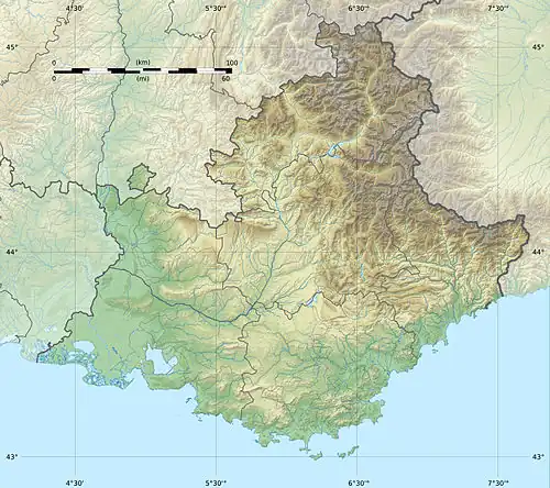 Parpaillon Massif  Parpaillon Massif | |
| Country | France |
| Departments | |
| Region | Provence-Alpes-Côte d'Azur |
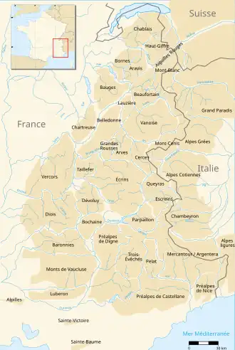
The Parpaillon massif (French: massif du Parpaillon, pronounced [masif dy paʁpajɔ̃]) are a massif in the French Alps. It serves as the boundary between the departments of Hautes-Alpes to the north and the Alpes-de-Haute-Provence to the south. Additionally, it separates the Embrun region from the Ubaye valley. The massif extends from the Serre-Ponçon lake in the west to the Col de Vars, which distinguishes it from the Escreins massif, and to the middle Ubaye valley in the southeast, near Saint-Paul-sur-Ubaye, where it is bordered by the Mercantour-Argentera massif and the Chambeyron massif.
Etymology
For some, the meaning of this toponym is papillon (transl. butterfly), which is "parpalhon" in Occitan.[1] However, it is more likely derived from the pre-Gaulish (Ligurian) term "pal," which is common in the names of mountains and escarpments.
Main summits
- Grand Bérard, 3,046 m
- Grand Parpaillon, 2,990 m
- Chalanche, 2,984 m
- Tête de Vallon Claous, 2,945 m
- Mont Tailland, 2,938 m
- Grande Combe, 2,937 m
- Tête de Crouès, 2,928 m
- Tête de Frusta, 2,926 m
- Barre de la Pisse, 2,925 m
- Tête du Crachet, 2,919 m
- Aupillon, 2,916 m
- Pouzenc, 2,898 m
- Grande Épervière, 2,884 m
- Pointe de l'Eyssina, 2,837 m
- Pic de Boussolenc, 2,832 m
- Montagnette, 2,811 m
- Pic de Chabrières, 2,727 m
- Pic de Morgon, 2,324 m
External links
![]() Media related to Massif du Parpaillon at Wikimedia Commons
Media related to Massif du Parpaillon at Wikimedia Commons
References
- ^ Nègre, Ernest (1996). Toponymie générale de la France (in French). Librairie Droz. p. 1192. ISBN 978-2-600-00133-5.
| Sections (as per SOIUSA) |
|  | ||||
|---|---|---|---|---|---|---|
| Other ranges | ||||||
| Massifs | ||||||