Paulina, Louisiana
Paulina, Louisiana | |
|---|---|
 Paulina, Louisiana  Paulina, Louisiana | |
| Coordinates: 30°01′35″N 90°42′47″W / 30.02639°N 90.71306°W | |
| Country | United States |
| State | Louisiana |
| Parish | St. James |
| Area | |
• Total | 5.31 sq mi (13.76 km2) |
| • Land | 4.62 sq mi (11.96 km2) |
| • Water | 0.69 sq mi (1.80 km2) |
| Elevation | 7 ft (2 m) |
| Population (2020) | |
• Total | 1,778 |
| • Density | 385.10/sq mi (148.68/km2) |
| Time zone | UTC-6 (Central (CST)) |
| • Summer (DST) | UTC-5 (CDT) |
| ZIP code | 70763 |
| Area code | 225 |
| GNIS feature ID | 2583544[2] |
Paulina is an unincorporated community and census-designated place in St. James Parish, Louisiana, United States. It was first listed in the 2010 census with a population of 1,178.[3] The community is located on the east bank of the Mississippi River in the eastern part of the parish, west of Lutcher and across the river from Vacherie. Paulina has a post office with ZIP code 70763.[4][5]
Demographics
| Census | Pop. | Note | %± |
|---|---|---|---|
| 2010 | 1,178 | — | |
| 2020 | 1,778 | 50.9% | |
| U.S. Decennial Census[6] 2010[7] 2020[8] | |||
| Race / Ethnicity (NH = Non-Hispanic) | Pop 2010[7] | Pop 2020[8] | % 2010 | % 2020 |
|---|---|---|---|---|
| White alone (NH) | 976 | 1,521 | 82.85% | 85.55% |
| Black or African American alone (NH) | 167 | 185 | 14.18% | 10.40% |
| Native American or Alaska Native alone (NH) | 4 | 0 | 0.34% | 0.00% |
| Asian alone (NH) | 4 | 0 | 0.34% | 0.00% |
| Native Hawaiian or Pacific Islander alone (NH) | 0 | 0 | 0.00% | 0.00% |
| Other race alone (NH) | 0 | 1 | 0.00% | 0.06% |
| Mixed race or Multiracial (NH) | 11 | 34 | 0.93% | 1.91% |
| Hispanic or Latino (any race) | 16 | 37 | 1.36% | 2.08% |
| Total | 1,178 | 1,778 | 100.00% | 100.00% |
References
- ^ "2020 U.S. Gazetteer Files". United States Census Bureau. Retrieved March 20, 2022.
- ^ a b "Paulina Census Designated Place". Geographic Names Information System. United States Geological Survey, United States Department of the Interior.
- ^ "US Gazetteer files: 2010, 2000, and 1990". United States Census Bureau. February 12, 2011. Retrieved April 23, 2011.
- ^ United States Postal Service. "USPS - Look Up a ZIP Code". Retrieved May 23, 2015.
- ^ "Postmaster Finder - Post Offices by ZIP Code". United States Postal Service. Retrieved May 23, 2015.
- ^ "Decennial Census of Population and Housing by Decade". US Census Bureau.
- ^ a b "P2 Hispanic or Latino, and Not Hispanic or Latino by Race – 2010: DEC Redistricting Data (PL 94-171) – Paulina CDP, Louisiana". United States Census Bureau.
- ^ a b "P2 Hispanic or Latino, and Not Hispanic or Latino by Race – 2020: DEC Redistricting Data (PL 94-171) - Paulina CDP, Louisiana". United States Census Bureau.
Municipalities and communities of St. James Parish, Louisiana, United States | ||
|---|---|---|
| Towns | 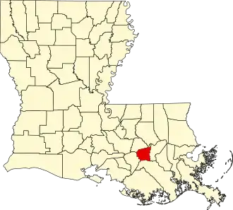 | |
| CDPs | ||
| Unincorporated community | ||
| Footnotes | ‡This populated place also has portions in an adjacent parish or parishes | |