Pavlová
Pavlová
Garampáld | |
|---|---|
 | |
 Flag  Coat of arms | |
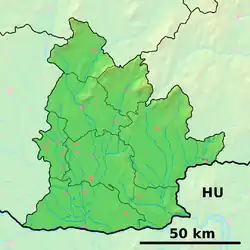 Pavlová Location of Pavlová in the Nitra Region  Pavlová Location of Pavlová in Slovakia | |
| Coordinates: 47°54′N 18°40′E / 47.90°N 18.67°E | |
| Country | |
| Region | |
| District | Nové Zámky District |
| First mentioned | 1135 |
| Area | |
• Total | 7.62 km2 (2.94 sq mi) |
| Elevation | 126 m (413 ft) |
| Population (2021)[3] | |
• Total | 202 |
| Time zone | UTC+1 (CET) |
| • Summer (DST) | UTC+2 (CEST) |
| Postal code | 943 59[2] |
| Area code | +421 36[2] |
| Car plate | NZ |
| Website | www |
Pavlová (Hungarian: Garampáld) is a village and municipality in the Nové Zámky District in the Nitra Region of south-west Slovakia.
History
In historical records the village was first mentioned in 1135, under the name Pauli.[4]
Geography
The municipality lies at an altitude of 137 metres and covers an area of 7.617 km2. It has a population of about 275 people.
Ethnicity
The population is about 95% Hungarian and 5% Slovak.
Facilities
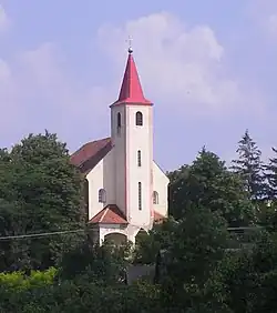
The village has a small public library and a football pitch. The Roman Catholic church of St. Lawrence was founded in the village in 1810.[4]
References
- ^ "Hustota obyvateľstva - obce [om7014rr_ukaz: Rozloha (Štvorcový meter)]". www.statistics.sk (in Slovak). Statistical Office of the Slovak Republic. 2022-03-31. Retrieved 2022-03-31.
- ^ a b c "Základná charakteristika". www.statistics.sk (in Slovak). Statistical Office of the Slovak Republic. 2015-04-17. Retrieved 2022-03-31.
- ^ "Počet obyvateľov podľa pohlavia - obce (ročne)". www.statistics.sk (in Slovak). Statistical Office of the Slovak Republic. 2022-03-31. Retrieved 2022-03-31.
- ^ a b Milan Paprčka; Simona Nádašiová (2016). Hont z neba. Banská Bystrica: CBS spol. ISBN 978-80-8144-109-7.
External links