Pernersdorf
Pernersdorf | |
|---|---|
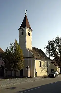 Pernersdorf chapel | |
 Coat of arms | |
 Pernersdorf Location within Austria | |
| Coordinates: 48°42′N 16°1′E / 48.700°N 16.017°E | |
| Country | Austria |
| State | Lower Austria |
| District | Hollabrunn |
| Government | |
| • Mayor | Eduard Kosch |
| Area | |
• Total | 25.84 km2 (9.98 sq mi) |
| Elevation | 214 m (702 ft) |
| Population (2018-01-01)[2] | |
• Total | 1,022 |
| • Density | 40/km2 (100/sq mi) |
| Time zone | UTC+1 (CET) |
| • Summer (DST) | UTC+2 (CEST) |
| Postal code | 2052 |
| Area code | 02944 |
| Website | www.pernersdorf.gv.at |
Pernersdorf is a town in the district of Hollabrunn in Lower Austria, Austria.
Geography
Pernersdorf lies in the Weinviertel in Lower Austria. Only about 1.06 percent of the municipality is forested.
References
- ^ "Dauersiedlungsraum der Gemeinden Politischen Bezirke und Bundesländer - Gebietsstand 1.1.2018". Statistics Austria. Retrieved 10 March 2019.
- ^ "Einwohnerzahl 1.1.2018 nach Gemeinden mit Status, Gebietsstand 1.1.2018". Statistics Austria. Retrieved 9 March 2019.