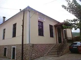
Petrokerasa
Petrokerasa
Πετροκέρασα | |
|---|---|
 | |
 Petrokerasa | |
| Coordinates: 40°31′N 23°17.1′E / 40.517°N 23.2850°E | |
| Country | Greece |
| Administrative region | Central Macedonia |
| Regional unit | Thessaloniki |
| Municipality | Lagkadas |
| Municipal unit | Kallindoia |
| Area | |
• Community | 27.398 km2 (10.578 sq mi) |
| Elevation | 520 m (1,710 ft) |
| Population (2021)[1] | |
• Community | 250 |
| • Density | 9.1/km2 (24/sq mi) |
| Time zone | UTC+2 (EET) |
| • Summer (DST) | UTC+3 (EEST) |
| Postal code | 570 12 |
| Area code(s) | +30-2393 |
| Vehicle registration | NA to NX |
Petrokerasa (Greek: Πετροκέρασα), known before 1927 as Ravna (Ραβνά),[2] is a village and a community of the Lagkadas municipality.[3] Before the 2011 local government reform it was part of the municipality of Kallindoia, of which it was a municipal district.[3] The 2021 census recorded 250 inhabitants in the village.[1] The community of Petrokerasa covers an area of 27.398 km2.[4]
See also
References
- ^ a b "Αποτελέσματα Απογραφής Πληθυσμού - Κατοικιών 2021, Μόνιμος Πληθυσμός κατά οικισμό" [Results of the 2021 Population - Housing Census, Permanent population by settlement] (in Greek). Hellenic Statistical Authority. 29 March 2024.
- ^ Μετονομασίες των Οικισμών της Ελλάδας. Ραβνά -- Πετροκέρασα
- ^ a b "ΦΕΚ B 1292/2010, Kallikratis reform municipalities" (in Greek). Government Gazette.
- ^ "Population & housing census 2001 (incl. area and average elevation)" (PDF) (in Greek). National Statistical Service of Greece.