Pic Ramougn
| Pic Ramougn | |
|---|---|
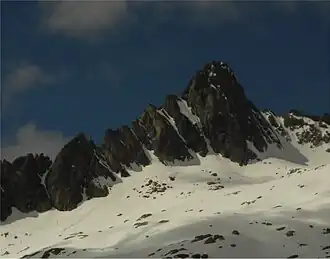 North side of Pic Ramougn from Hourquette d'Aubert | |
| Highest point | |
| Elevation | 3,011 m (9,879 ft) |
| Coordinates | 42°50′06″N 00°07′12″E / 42.83500°N 0.12000°E |
| Geography | |
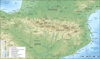 Pic Ramougn Location in the Pyrenees | |
| Location | Hautes-Pyrénées, France |
| Parent range | Pyrenees |
| Geology | |
| Mountain type | Granite |
Pic Ramougn (3,011 m) is a steep, rocky mountain in the Néouvielle massif in the Pyrenees.
It is located in the commune of Saint-Lary-Soulan within the department of the Hautes-Pyrénées, and is named after the French politician, geologist and botanist Louis Ramond de Carbonnières. Ramougn is the pronunciation of Ramond in the Gascon language.