Pic du Gar
| Pic du Gar | |
|---|---|
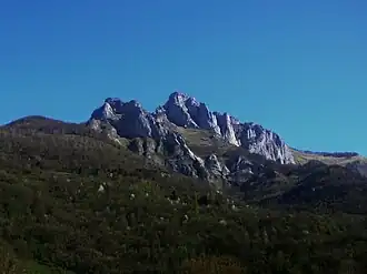 Pic du Gar (right) seen from Eup | |
| Highest point | |
| Elevation | 1,785 m (5,856 ft) |
| Coordinates | 42°56′55″N 0°41′47″E / 42.94861°N 0.69639°E |
| Geography | |
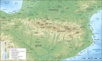 Pic du Gar Location in the Pyrenees | |
| Location | Haute-Garonne, France |
| Parent range | Pyrenees |
| Geology | |
| Mountain type | Karstic |
| Climbing | |
| First ascent | Unknown |
| Easiest route | From Eup or Saint-Pé-d'Ardet |
Pic du Gar is a mountain of the Pyrenees. It is located near Saint-Béat, Haute-Garonne département, in the Comminges natural region. The limestone mountain has an altitude of 1,785 metres (5,856 ft) above sea level.[1]
Despite its relatively low altitude, the Pic du Gar, like the Pic de Cagire, is a well-known summit of the Haute-Garonne. Its imposing silhouette dominates the high valley of the Garonne, after flowing from the Val d'Aran. Its secondary summit, the Pic Saillant (1756 m), has a summit cross.
References
- ^ "Pic du Gar" (in French). Info-Pyrenees. Archived from the original on 16 February 2003. Retrieved 28 May 2011.
External links