Pichl-Kainisch
Pichl-Kainisch | |
|---|---|
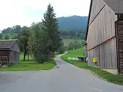 Street in Pichl-Kainisch | |
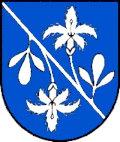 Coat of arms | |
 Pichl-Kainisch Location within Austria | |
| Coordinates: 47°34′10″N 13°51′14″E / 47.56944°N 13.85389°E | |
| Country | Austria |
| State | Styria |
| District | Liezen |
| Area | |
• Total | 29.84 km2 (11.52 sq mi) |
| Elevation | 803 m (2,635 ft) |
| Population (1 January 2016)[1] | |
• Total | 743 |
| • Density | 25/km2 (64/sq mi) |
| Time zone | UTC+1 (CET) |
| • Summer (DST) | UTC+2 (CEST) |
| Postal code | 8984 |
| Area code | 03624 |
| Vehicle registration | LI |
| Website | www.pichl-kainisch.at |
Pichl-Kainisch is a former municipality in the Salzkammergut in the Liezen (district) Austrian state of Styria. Since the 2015 Styria municipal structural reform, it is part of the municipality Bad Mitterndorf.[2]
Population
| Year | Pop. | ±% |
|---|---|---|
| 1971 | 626 | — |
| 1981 | 659 | +5.3% |
| 1991 | 718 | +9.0% |
| 2001 | 782 | +8.9% |
| 2013 | 759 | −2.9% |
Territorial Division
The municipal area included four localities[3] (population on January 1, 2017 according to localities):
Outer Kainic (277)
buttons (193)
Muhlreith (75)
Pichl near Aussee (195)
The community consisted of the only cadastral community Pichl.
References
- ^ Statistik Austria - Bevölkerung zu Jahresbeginn 2002-2016 nach Gemeinden (Gebietsstand 1.1.2016) for Pichl-Kainisch.
- ^ Die neue Gemeindestruktur der Steiermark
- ^ "Bevölkerung zu Jahres-/Quartalsanfang". STATISTIK AUSTRIA (in Austrian German). Retrieved 2023-04-25.