Pit 6 Dam
| Pit No. 6 Dam | |
|---|---|
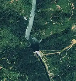 Satellite view | |
| Country | United States |
| Location | Shasta County, California |
| Coordinates | 40°55′23″N 121°59′38″W / 40.92306°N 121.99389°W |
| Opening date | 1965 |
| Owner(s) | PG&E |
| Dam and spillways | |
| Type of dam | Concrete gravity |
| Impounds | Pit River |
| Height | 172 ft (52 m) |
| Length | 560 ft (170 m) |
| Reservoir | |
| Total capacity | 15,700 acre⋅ft (19,400,000 m3) |
| Catchment area | 5,020 sq mi (13,000 km2) |
| Surface area | 265 acres (107 ha) |
| Power Station | |
| Installed capacity | 79 MW |
| Annual generation | 341,850,000 KWh (2001–2012)[1] |
Pit No. 6 Dam or Pit 6 Dam is a hydroelectric dam on the Pit River in northern California. Its power station generates up to 79 MW.[2]
The dam, built in 1965, is owned by the Pacific Gas and Electric Company. It is 172 feet (52 m) tall and forms the Pit Six Reservoir, which has a capacity of 15,700 acre-feet (19,400,000 m3).[3]
See also
References
- ^ "California Hydroelectric Statistics & Data". California Energy Commission. Archived from the original on 2018-02-26. Retrieved 2018-04-27.
- ^ "Project Summary - McCloud-Pit". Energy NewsData. Retrieved 2011-10-22.
- ^ "Dams Within the Jurisdiction of the State of California (N-S)" (PDF). California Department of Water Resources, Division of Safety of Dams. Archived from the original (PDF) on October 5, 2012. Retrieved November 20, 2012.