Pizzo Paglia
| Pizzo Paglia | |
|---|---|
 | |
| Highest point | |
| Elevation | 2,593 m (8,507 ft) |
| Prominence | 498 m (1,634 ft)[1] |
| Isolation | 10.3 km (6.4 mi)[2] |
| Coordinates | 46°13′55″N 09°13′09″E / 46.23194°N 9.21917°E |
| Geography | |
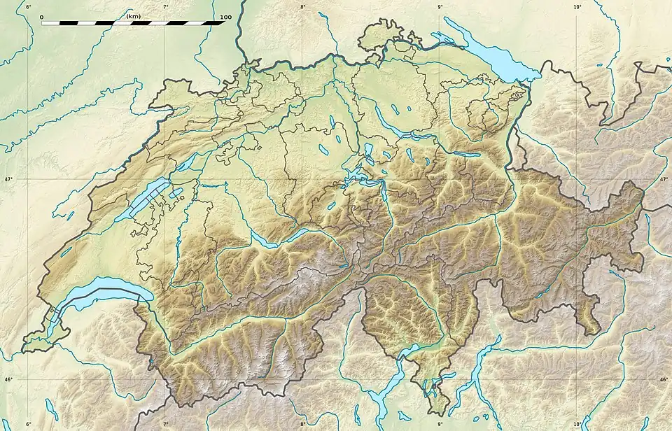 Pizzo Paglia Location in Switzerland | |
| Location | Graubünden, Switzerland (mountain partially in Italy) |
| Parent range | Lepontine Alps |
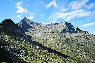
Pizzo Paglia is a mountain of the Lepontine Alps, overlooking the Val Cama in the canton of Graubünden. The border with Italy runs 300 metres south of the summit.
See also
References
- ^ Retrieved from the Swisstopo topographic maps (1:25,000). The key col is the Bocchetta del Notar (2,095 m).
- ^ Retrieved from Google Earth. The nearest point of higher elevation is southeast of Piz della Molera (Piz de Groven massif).
External links