Langemark-Poelkapelle
Langemark-Poelkapelle | |
|---|---|
 | |
 Flag  Coat of arms | |
Location of Langemark-Poelkapelle | |
 Langemark-Poelkapelle Location in Belgium
Location of Langemark-Poelkapelle in West Flanders 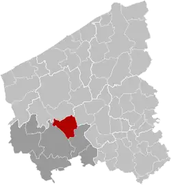 | |
| Coordinates: 50°55′N 02°55′E / 50.917°N 2.917°E | |
| Country | Belgium |
| Community | Flemish Community |
| Region | Flemish Region |
| Province | |
| Arrondissement | Ypres |
| Government | |
| • Mayor | Dominique Cool (N-VA) |
| • Governing party/ies | CD&V, N-VA |
| Area | |
• Total | 53.07 km2 (20.49 sq mi) |
| Population (2018-01-01)[1] | |
• Total | 7,920 |
| • Density | 150/km2 (390/sq mi) |
| Postal codes | 8920 |
| NIS code | 33040 |
| Area codes | 057, 051 |
| Website | www.langemark-poelkapelle.be |
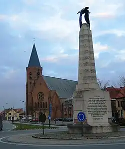
Langemark-Poelkapelle (Dutch pronunciation: [ˈlɑŋəˌmɑr(ə)k ˌpulkaːˈpɛlə]) is a municipality located in the Belgian province of West Flanders.
Geography
Other places in the municipality include Bikschote, Langemark and Poelkapelle. On January 1, 2006, Langemark-Poelkapelle had a total population of 7,780. The total area is 52.53 square kilometres (20.28 sq mi) which gives a population density of 148 inhabitants per km2.
Gallery
-
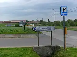
 Farm at Langemark
 -
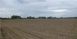 Fields at Langemark
 -
See also
References
- ^ "Wettelijke Bevolking per gemeente op 1 januari 2018". Statbel. Retrieved 9 March 2019.
External links
 Media related to Langemark-Poelkapelle at Wikimedia Commons
- Official Website (in Dutch)
Places adjacent to Langemark-Poelkapelle | ||||||||||||||||
|---|---|---|---|---|---|---|---|---|---|---|---|---|---|---|---|---|
| ||||||||||||||||
| Bruges | 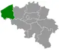 | |
|---|---|---|
| Diksmuide | ||
| Kortrijk | ||
| Ostend | ||
| Roeselare | ||
| Tielt | ||
| Veurne | ||
| Ypres | ||
| ||