Port de Lers
| Port de Lers | |
|---|---|
 | |
| Elevation | 1,517 m (4,977 ft)[1] |
| Traversed by | D18 |
| Location | Ariège, France |
| Range | Pyrenees |
| Coordinates | 42°48′23″N 1°24′41″E / 42.80639°N 1.41139°E |
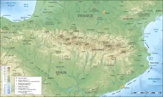 Port de Lers Location in the Pyrenees | |
The Port de Lers (or Port de l'Hers or Port de Massat) (elevation 1,517 m (4,977 ft)) is a mountain pass in the French Pyrenees in the department of Ariège, between the communities of Aulus-les-Bains (west), Massat (north) and Vicdessos (east).
Details of climb
Starting from Vicdessos, the climb is 11.5 km (7.1 mi) long. Over this distance, the climb is 807 m (2,648 ft) (an average of 7.0%), with the steepest section being at 10.9%.[2]
Starting from Massat, the climb is 16.6 km (10.3 mi) long. Over this distance, the climb is 868 m (2,848 ft) (an average of 5.2%), with the steepest sections being at 8.9%.[3]
Appearances in Tour de France
The Port de Lers was first used in the Tour de France in 1995, since when it has featured seven times, most recently in 2024.[4]
| Year | Stage | Category | Start | Finish | Leader at the summit* |
|---|---|---|---|---|---|
| 2022 | 16 | 1 | Carcassonne | Foix | |
| 2019 | 15 | 1 | Limoux | Foix Prat d'Albis | |
| 2015 | 12 | 1 | Lannemezan | Plateau de Beille | |
| 2012 | 14 | 1 | Limoux | Foix | |
| 2011 | 14 | 3 | Saint-Gaudens | Plateau de Beille | |
| 2004 | 13 | 3 | Lannemezan | Plateau de Beille | |
| 1995 | 14 | 2 | Saint-Orens-de-Gameville | Guzet-Neige |
References
- ^ IGN map
- ^ "Port de Lers from Vicdessos : 1517m". Cols-cyclisme. Retrieved 2025-07-31.
- ^ "Port de Lers from Massat : 1517m". Cols-cyclisme. Retrieved 2025-07-31.
- ^ "Le Port de Lers dans le Tour de France" (in French). Retrieved 14 July 2024.