Prasadampadu
Prasadampadu | |
|---|---|
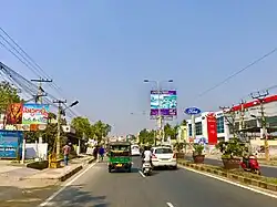 AH-45 in Prasadampadu | |
.svg.png) Prasadampadu | |
| Coordinates: 16°31′10″N 80°41′21″E / 16.51944°N 80.68917°E | |
| Country | |
| State | Andhra Pradesh |
| Region | Coastal Andhra |
| District | NTR |
| Mandal | Vijayawada Rural mandal |
| City | Vijayawada |
| Metropolitan Area | Andhra Pradesh Capital Region |
| Area | |
• Total | 2.40 km2 (0.93 sq mi) |
| Elevation | 21 m (69 ft) |
| Population (2011) | |
• Total | 13,941 |
| • Density | 5,800/km2 (15,000/sq mi) |
| Time zone | UTC+5:30 (IST) |
| PIN | 521108 |
| Telephone code | +91-866 |
Prasadampadu is a part of Vijayawada in NTR district of the Indian state of Andhra Pradesh. It is located in Vijayawada (rural) mandal of Vijayawada revenue division.[1] As per the G.O. No. M.S.104 (dated:23-03-2017), Municipal Administration and Urban Development Department, it became a part of Vijayawada metropolitan area.[2][3]
See also
References
- ^ "District Census Handbook - Krishna" (PDF). Census of India. p. 17,48. Retrieved 18 January 2015.
- ^ Staff Reporter. "Vijayawada, 19 other contiguous areas notified as Metropolitan Area". The Hindu. Retrieved 27 March 2017.
- ^ "Welcome to Government Order Issue Register". goir.ap.gov.in. Retrieved 27 March 2017.