Presnovka (Zhambyl District)
Presnovka
Пресновка | |
|---|---|
Village | |
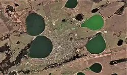 Presnovka is located between four small lakes | |
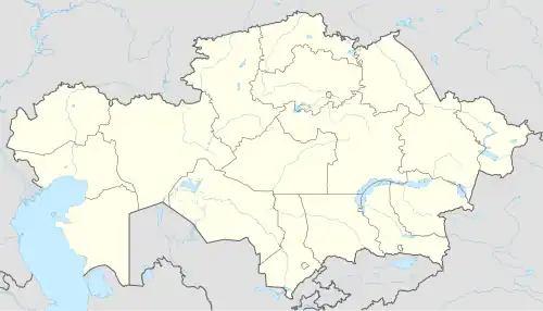 Presnovka Location in Kazakhstan | |
| Coordinates: 54°40′00″N 67°08′36″E / 54.66667°N 67.14333°E | |
| Country | Kazakhstan |
| Region | North Kazakhstan Region |
| District | Zhambyl District |
| Rural District | Presnov Rural District |
| Population (2019) | |
• Total | 5,322 |
| Time zone | UTC+6 (East Kazakhstan Time) |
| Post code | 150600 |
Presnovka (Kazakh: Пресновка) is a village and the administrative center of Zhambyl District, North Kazakhstan Region, Kazakhstan. It is also the head of Presnov Rural District (KATO code - 594630100). Presnovka was founded as a military fort in March 1752.[1][2] Population: 5,725 (2009 census results);[3] 6,585 (1999 census results).[3]
Geography
Presnovka lies near the Kazakhstan-Russia border, 12 kilometers (7.5 mi) to the south of lake Filatovo and 49 kilometers (30 mi) to the west of lake Menkeser.[4]
References
- ^ Государственные органы GOV.KZ – Единая платформа интернет-ресурсов госорганов
- ^ Акиматы районов, г. Петропавловска (in Russian). Акимат Северо-Казахстанской области. Archived from the original on 18 May 2015. Retrieved 10 May 2015.
- ^ a b "Население Республики Казахстан" [Population of the Republic of Kazakhstan] (in Russian). Департамент социальной и демографической статистики. Retrieved 8 December 2013.
- ^ "N-42 Topographic Chart (in Russian)". Retrieved 15 August 2024.
Capital: Petropavl | ||
| Districts | 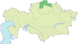 | |
| Major population centres | ||